Ring the Peak Trail Run
June 12th, 2010
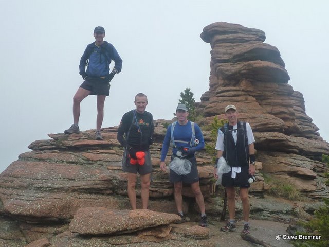
Rick Hessek, Paul DeWitt, Nick Starkey, Steve Bremner
17 hours 30 minutes, 64.5 miles, 13,200’ elevation gain/loss
Report by Steve Bremner
When I first heard about the 65-mile Ring the Peak Trail around Pikes Peak I knew that one day I would have to run the whole thing. It just didn’t seem though that they would ever complete the trail. There are a couple of segments that may take some time to complete: The first segment is where the Ute Pass Trail ends on the north side along highway 24 and the other a nearly twenty mile segment on the south slopes of Pikes Peak. Private property issues and the decision of the Forest Service and Colorado Springs Utilities, not to interfere with the Bighorn Sheep lambing area have postponed the completion of the trail. I couldn’t wait forever.
The Ring the Peak trail has been completed in one day on at least two occasions by mountain bikers, but they resorted to biking on the highway over the two unfinished sections. For aesthetic reasons, as a runner, I wanted my experience to be on trails for as much as possible. Last October, perhaps foolishly, I made my first attempt at running Ring the Peak as a solo effort. There were some patches of snow on the ground in Manitou Springs when I started out, but I had no idea how deep it would get by the time I reached the western slopes. I made a three-part YouTube movie of that attempt, aborted after about 25 miles, which is archived on the web: Part 1; Part 2; Part 3. I hadn’t even scouted the southern slopes before that attempt. By the time I decided to abort the attempt I found myself slogging through snow up to mid-shin. I don’t know what I was thinking of. Sometimes I wonder if I am an incredible optimist or just a damned fool.
I resolved to make good on doing this thing this summer, and after a few emails back and forth on the CRUD (Coloradans Running Ultra Distances) email group we set a date of June 12th for the first “Annual CRUD Ring the Peak Fun Run.” We first had some scouting to do though in order to make it as much on trails as possible. Rick Hessek and I did two scouting sessions on the South Slopes, first scouting a route from where the trail now ends on Forest Road 376 off Old Stage Road over to near Gillette. The following weekend we scouted a route from the top of Pancake Rocks to Gillette, filling in the missing section on the South Slopes with trails, bushwhacking, dirt roads, and the occasional fence hopping. For the section after Ute Pass, rather than drop down to Highway 24 as the current route shows, I had already scouted a route straight up French Creek from the Ute Pass Trail to Hurricane Canyon, then over to Manitou Reservoir on a primitive trail. We had a viable, if improvised, route around the Peak that would keep us on dirt and off pavement except for a couple of short segments, one for about a quarter of a mile on the Pikes Peak Toll Road and the other being about two miles along Crystal Park Road in Manitou Springs.
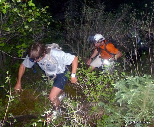
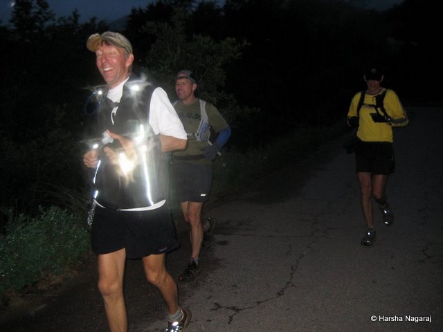
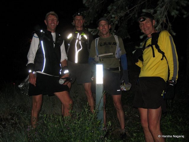
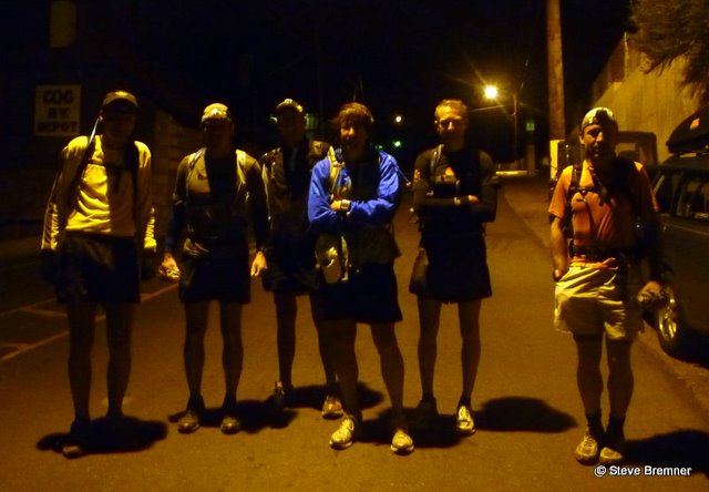
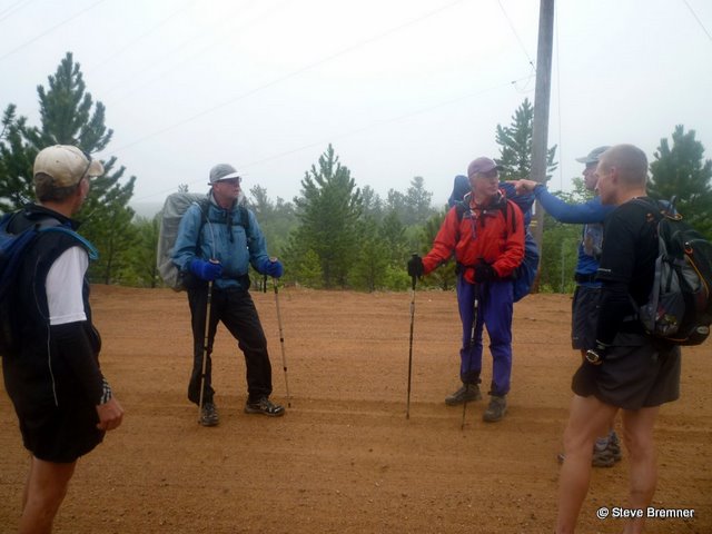
At four in the morning on June 12th, seven CRUDers lined up by the Cog Railroad terminal to start the long trek: Rick Hessek, Paul DeWitt, Nick Starkey, and I (Steve Bremner) would make the entire loop that day, finishing at 9:30 that night after 17 hours and 30 minutes. Paul Doyle and Brandon Salisbury went the first 21 miles with us, taking a ride back to Colorado Springs with Rebekka who provided the first “aide station” at the Crags Campground. Rich Muzzy kept going with us past the Crags to the next “aide station” near Gillette at 31 miles, where Harsha Nagaraj joined us for the final 34 miles.
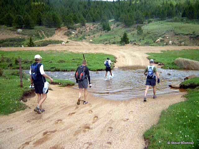
The first few miles we rolled along the Ute Pass Trail with headlamps, continuing on the dirt road past Longs Ranch Road before branching left towards the French Creek Dam. There is a “way” straight up French Creek that is somewhere between an all-out bush-whack and a trail: I call this in-between sort of pathway a “way” because it doesn’t quite warrant being called a “trail.” There were some mutterings of mutiny as I led a stalwart charge up the steep slopes. Paul DeWitt asked “why don’t we just go down to the highway?” I would have none of that kind of talk though. I had scouted and schemed and laid out the course over weeks of preparation just so we could do it on trails. No highway, no way.
The “way” stays to the left of the French Creek before cresting and dropping down to the confluence of the North and South Forks of French Creek. We crossed the creek following the seldom-visited trail that leads to the Manitou Reservoir. We passed through a couple of meadows as daylight emerged. At Manitou Reservoir we turned down the dirt road, running fluidly downhill. Before we reached the Pikes Peak Toll Road we passed the trailhead to the Severy Creek Trail: closed for years due to the endangered Greenback cutthroat trout, with an estimated population of only 2,000 fish surviving in the wild.
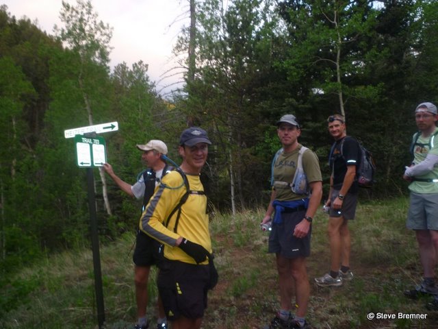
We ran the short segment up the toll road to the Crowe Gulch Trailhead, following that trail for a couple of miles before intersecting once again with the official Ring the Peak trail, which comes up the Mt Ester Trail from Highway 24 at Chipita Park. We would remain on the official Ring the Peak trail for the next more than twenty miles until its present terminus at Pancake Rocks.
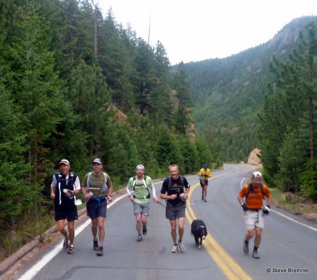
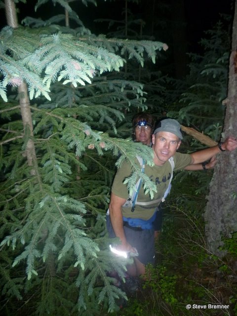
After traversing some nice meadows, the trail goes through woods, then up a utility road for a ways before turning back into the woods on single track trail again, winding around some nice rock formations before dropping down to Crystal Reservoir. The seven of us ran like an accordion, the distance between the first and last runners reaching as much as a quarter of a mile or so at times, but retracting back eventually. Near Catamount Reservoir we came on two backpackers who were hiking the entire trail over three days. They had heard about our intended effort to run it in a day from Neal and Teresa Taylor, caretakers of Barr Camp. They asked how we were intending to go through the South Slopes region, recounting a difficult trek around Sheep Mountain and a fiasco down a ravine that sounded epic. After hearing that story I was glad we had already scouted a good route.
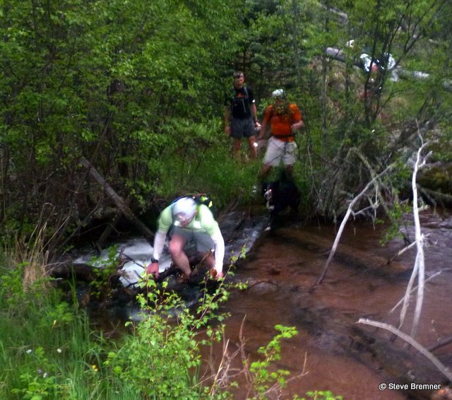
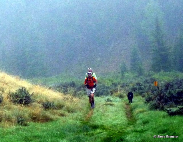
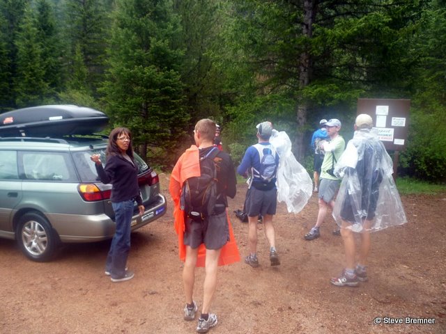
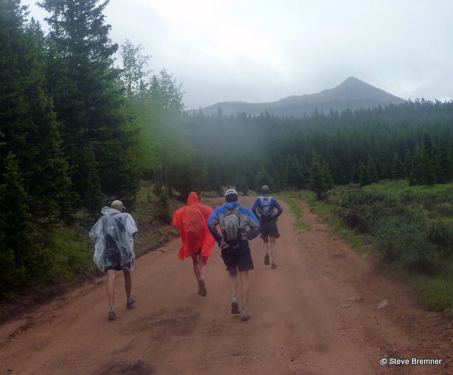
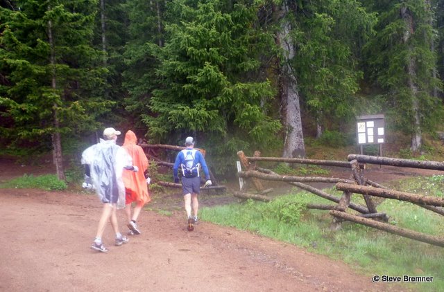
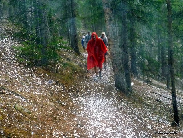
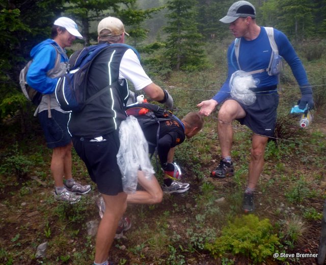
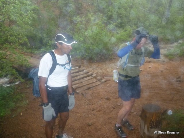
The trail follows dirt roads along the Catamount Reservoirs for about five miles before turning off onto the Limber Pine Trail for a mile or so. The next section is one of my favorite sections of the trail. An old 4X4 track leads up a wide valley with beaver ponds to the left and open meadows. The weather was threatening rain and mists hung over the ponds. Brandon’s dog took off “free lancing” and Paul and Brandon dropped back to wait for his return. Eventually the wayward animal returned to the pack and they caught back up to us as we climbed up to the crest of the “sleeping dragon” that was our portal to the western slopes of the Peak. I remembered very different circumstances during last October’s attempt on the trail, when as I ascended to the pass the snow got deeper and deeper. On this day in June we had no snow, but it had started to rain on us. 21 miles into the run, bedecked in ponchos and jackets, we dropped down to the Crags Campground Road “Aide Station” that Rebekka had graciously prepared for us. Brandon, his dog, and Paul had come to the end of their day’s running and took the ride back to Manitou Springs with Rebekka. Paul DeWitt, Rick Hessek, Nick Starkey, Rich Muzzy and I continued for a couple miles on the road past the campground to a trail that climbs to 10,500’ elevation before it crests at the head of Putney Gulch. Last October it was here trudging in the deep snow, with nightfall rapidly approaching, and the temperature dropping into the mid 20’s, that I decided to terminate my attempt. I broke out my cell phone and called Rebekka and asked her to meet me on Highway 67 after a quick decision to bushwhack down Putney Gulch. With a small measure of satisfaction I noted the landmark where I had quit the attempt and we pressed on. The rain which had stopped for a couple of hours started back in earnest and we broke out the ponchos again, the trail rolling up and down through some impressive country with beaver ponds and open meadows shrouded in mist. The overcast skies and misty precipitation (no hard rain) were perfect for a long day’s run. Eventually we reached Horsethief Park, where Rick and I had some moments of doubt when we thought we might have missed the Ring the Peak trail turn and thought we were on the trail towards the waterfall. Shortly afterwards though we espied another Ring the Peak trail sign and started the long steep climb to Pancake Rocks. Before Pancake Rocks we heard a clap of thunder, followed shortly by ten-minutes of pea-sized hail. The good news was that was the end of the day’s precipitation (on our heads at least, Colorado Springs on the other hand suffered a near deluge.)
From the Pancake Rock formations we followed an old jeep road south all the way down to Oil Creek. We crossed the creek ignoring “No Trespassing” signs because our prior scouting expedition had shown this to be bank foreclosure properties. No one was around. We followed a dirt road for a short ways before crossing a fence into a pasture, where on the other side we found a trail from our scouting trip to Cripple Creek Reservoir #2. After a mile or two the trail dumped out on the dirt road by the reservoir and we ambled down the road to the gate for the reservoir’s “fishing club.” The road passed through two high fences enclosing a couple dozen curious and highly social wolves. We met Harsha Nagaraj here. His wife and kids were a little further down the road manning our second “Aide Station” and providing Rich Muzzy’s ride home after 31 miles of running. Nick Starkey had been planning on quitting here as well, but made a spur of the moment decision to keep going for the duration. This was quite remarkable since Nick’s longest run ever prior to this 64.5 mile adventure run had been 23 miles on road!!
The next segment was all ad lib following routes Rick and I had discovered on our scouting trips. I’m going to gloss over much of this section due to private property concerns, but our course from Gillette took us partly along dirt roads, part bushwhacking, past the south side of Bison Reservoir, then down an old jeep road to a broad valley system where we found another old jeep road that Rick and I had scouted out that led steeply up past a cabin ruin and into Bull Park, a broad marshy basin at 10,000 feet in elevation. We connected here with a 4-wheel drive road that we followed up to our high point of the trek at 11,600’, where Rick and I had come on five bighorn sheep while scouting the course. We stopped here for a moment of rest. Paul told me I looked bad and should eat something. I looked through my stores and realized that I had not picked up any bars at any of the two aide stations and all I had to eat were gels. I bummed a Clif Bar off Rick which I nibbled on for the next half hour or so. Not long after this I ran out of water and we didn’t come on water for another hour. I started to lag behind. This was becoming an ordeal. We had logged about 43 miles by then but had another 20 miles or more to go.
We dropped down to Forest Road 376 rejoining the Ring the Peak trail once again. One big climb then mostly downhill for a long ways, all the way down to the start of Section 16. After what seemed like forever we finally came on a creek where I was able to fill up my camel-bak. Rick asked me if I wanted an iodine pill. At first I said no, but then allowed that I might take one. Nick said “that’s a lot of water, better take two.” Okay. I think that’s the first time I’ve ever used iodine pills. The only time I’ve used filters is in the deserts of Utah or Arizona. With the water I revived quickly and picked up the pace, actually moving into the lead for a couple of miles. We dropped down past Frosty Park and into Jones Park. Now we were on familiar stomping grounds. Relentless downhill running, we were dropping down towards Colorado Springs now. Down, down, down. Bear Creek trail, down, down, down. I sure didn’t remember this section of the trail as being this long. I dreaded the prospect of running up Section 16, down to the Intemann Trail, and then Manitou Springs. Just before High Drive off the Bear Creek Trail the others had stopped for water. I kept going. Walking slowly down the road I enjoyed how it felt on my legs to be walking, not running, expecting the others to come running past me at which point I would have to run again. They never came! I walked all the way down High Drive to the trailhead for Section 16, looked back, only to see them walking down the road and resting just like I had done! We had a long ways to go before we could rest and they had all taken advantage of a moment to rest their legs. I couldn’t remember the last time I had run up this trail segment up Section 16. Usually I run down this trail. I anticipated it to be steep and difficult but it wasn’t as bad as I thought it would be. As the others ran the ups I mostly walked, falling back. I called Rebekka to let her know we were about two hours out so she could meet us down by the Cog Railway and left my cell phone on. A few minutes later my phone rang. John Genet was asking where we were on the course! When I told him Section 16 he said, you’re almost done! No, I insisted. We still had to run down the steep section to the Intemann Trail traverse over to Crystal Park Road, run down the road, over to the Intemann Trail and traverse above Manitou Springs to Ruxton Avenue. It seemed like an interminably long ways at that point. Forever. I kept the others in sight, but I was lagging behind. Finally we reached Crystal Park Road where we ran down together as darkness fell.
Joining the Intemann Trail at the cemetery we donned our headlamps for the final two miles of trail. Trudging on, running the downs, walking the ups I fell back 50 yards or so, but when we finally reached Spring Street I caught back up to the group and we jogged in the final stretch of trail alongside Ruxton Creek to Iron Springs Chateau. Unbelievable. We had made it. Rebekka was there parked on the roadside. We touched the Ring the Peak sign where we had started 17 and a half hours ago, completing the circle. As far as we know, the first ever one-day run of the Ring the Peak Trail around Pikes Peak: 64.5 miles, 13,200’ elevation gain/loss, 17 hours and 30 minutes.