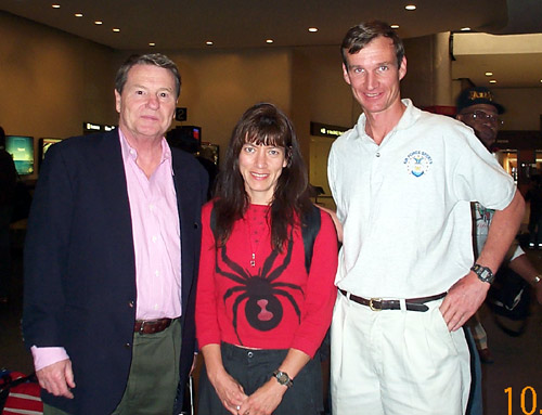
 Jim
Lehrer of PBS also awaiting his luggage. Graciously he consented to a picture
with the three of us.
Jim
Lehrer of PBS also awaiting his luggage. Graciously he consented to a picture
with the three of us.Laila Hughes and Steve Bremner
October 18, 2000
High Point Bagging
West
Virginia: Spruce Knob
Maryland:
Backbone Mtn
Pennsylvania:
Davis Mtn
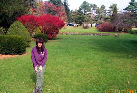
Laila and I came out to D.C. to run the Marine Corps Marathon on the 22nd of October. I as part of the Air Force team competing in the third annual military marathon championships. Laila I had managed to get an entry in July though the race had been closed for months...a record three days is all it took to fill the 20,000 allowable participants way back in March! As long as we were back east we decided to try and knock off a few state high points...
Arriving on separate
flights, Laila from Salt Lake City and myself from Colorado Springs we connected
at Washington National. While awaiting Laila's luggage we spotted
Jim
Lehrer of PBS also awaiting his luggage. Graciously he consented to a picture
with the three of us.
Shortly afterwards we picked up our rental car, and proceeded to Winchester, VA where that night we would stay with my longtime friend, the Reverend James Dean, Doctor of Divinity. James and I go way back to 1982 when we met at Keesler AFB, new recruits in the Air Force.
 After Keesler we parted
ways, but stayed in touch. When I later went to Germany, Jim was stationed in
Berlin. With my family of the time we visited him by taking the troop train
from Frankfurt to Berlin in 1985, before the wall came down. Later he visited
us in Frankfurt and we took a vacation to Austria together. Jim, originally
from Winchester, now works for FEMA as a systems administrator for computer
systems.
After Keesler we parted
ways, but stayed in touch. When I later went to Germany, Jim was stationed in
Berlin. With my family of the time we visited him by taking the troop train
from Frankfurt to Berlin in 1985, before the wall came down. Later he visited
us in Frankfurt and we took a vacation to Austria together. Jim, originally
from Winchester, now works for FEMA as a systems administrator for computer
systems.
 The
next morning, October 19th, we were up and at 'em early. Jim suggested that
we may have too ambitious of an agenda if we intended to climb all three high
points AND arrive back at Washington National by 5 PM. After driving for a couple
hours on highway 50 West, we stopped for breakfast. As might be expected back
in the hills (at Deb's diner) the price was reasonable and the eggs and hash
browns hit the spot.
The
next morning, October 19th, we were up and at 'em early. Jim suggested that
we may have too ambitious of an agenda if we intended to climb all three high
points AND arrive back at Washington National by 5 PM. After driving for a couple
hours on highway 50 West, we stopped for breakfast. As might be expected back
in the hills (at Deb's diner) the price was reasonable and the eggs and hash
browns hit the spot.
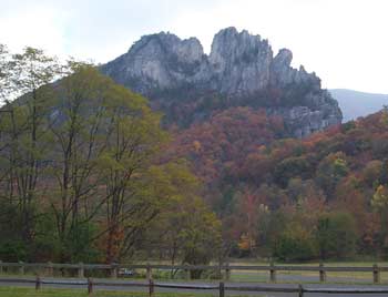
The roads were mountain roads, meaning the time required to negotiate them was lengthy. After some time we left hiway 50 and headed south past Seneca Rocks, shown at left.
Along the way we passed
a most pictureque river and stopped for a couple pictures. I also got a bonus
when I found a pair of sunglasses by the river. 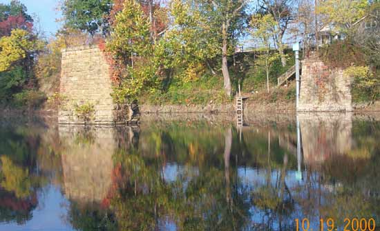
 We
were slowly making our way towards the high point for West Virginia. Unfortunately
the Internet report I had printed out of the description left very much to be
desired. Why is it that people do these high points, write a trip report, but
fail to accurately describe the correct way to do the high point?? I mean why
else will people be reading their trip reports unless they plan to do the trip
themselves? Why not explain explicitly how to do the deed??
We
were slowly making our way towards the high point for West Virginia. Unfortunately
the Internet report I had printed out of the description left very much to be
desired. Why is it that people do these high points, write a trip report, but
fail to accurately describe the correct way to do the high point?? I mean why
else will people be reading their trip reports unless they plan to do the trip
themselves? Why not explain explicitly how to do the deed??
 The
description we were going by just sort of vaguely talked about "15 miles
outside of Franklin we took the narrow and partly paved... road". WELL,
pray tell exactly where is this road?? It is not marked "high point"
or "Spruce Knob". So I am here to give ACCURATE directions! Two miles
south of Seneca Caverns where the Gateway Family Restaurant is off highway 28,
turn right (if you are going south) follow signs to Spruce Knob. We passed this
turn off and added many miles to our journey, but ended up finding it after
quite some time.
The
description we were going by just sort of vaguely talked about "15 miles
outside of Franklin we took the narrow and partly paved... road". WELL,
pray tell exactly where is this road?? It is not marked "high point"
or "Spruce Knob". So I am here to give ACCURATE directions! Two miles
south of Seneca Caverns where the Gateway Family Restaurant is off highway 28,
turn right (if you are going south) follow signs to Spruce Knob. We passed this
turn off and added many miles to our journey, but ended up finding it after
quite some time.
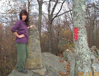
Spruce Knob is quite alpine. As we were driving up the road I wondered where could the spruce be? After all on the lower reaches it was all deciduous trees. Once we reached the higher elevations the spruce came in view. At the summit they were obviously punished by the wind as they leaned ever eastward.
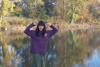
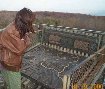
 What
a beautiful panorama. What a beautiful subject for the foreground! My passionate
Spanish lady, Laila!
What
a beautiful panorama. What a beautiful subject for the foreground! My passionate
Spanish lady, Laila!
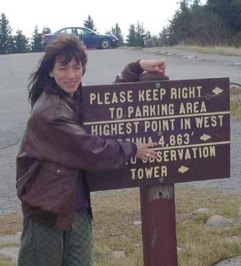
Next highpoint on the agenda was Maryland. Again the descriptions from the Internet trip reports left much to be desired. Vaguely referring to "the Estates" which I never did find they talked about the trail head being half a mile south of the "Estates". Well it would have been much clearer if they simply said half a mile south of the town of Silver Lake, WV. There is a dirt road leading left at that point with red spray painted indications for MD Highpoint on the trees. We were able to drive for just a short ways before being forced to park. On the way back down we assisted someone more foolish as they tried to free their 4-wheel drive vehicle from the mud as they had attempted to go further.
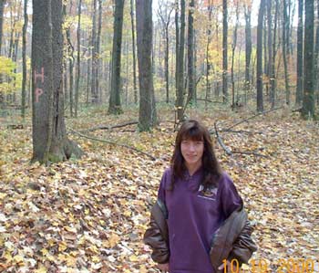 The
trail was easy enough to follow. Simply go up and follow the red arrows marked
on the trees. Close to the summit it became just a tad confusing. A sign pointed
left to the Maryland highpoint, but another sign pointed right to the highpoint.
It turned out either way led to the same goal. By going right we went by an
old border marker from the last century. A bit further was the real high point.
Surrounded by woods the view was not extensive, but the isolation and quiet
on this fall day was profound.
The
trail was easy enough to follow. Simply go up and follow the red arrows marked
on the trees. Close to the summit it became just a tad confusing. A sign pointed
left to the Maryland highpoint, but another sign pointed right to the highpoint.
It turned out either way led to the same goal. By going right we went by an
old border marker from the last century. A bit further was the real high point.
Surrounded by woods the view was not extensive, but the isolation and quiet
on this fall day was profound.
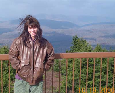
Now we had but one more high point and we would be done for the day and ready to drive back to D.C.
Entering Pennsylvania we were pleasantly surprised to find ourselves
driving through Amish country. We saw a couple riding in an old black carriage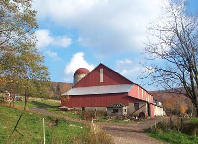 pulled by a single horse. Later we saw three bearded men by a barn clad in traditional
old German clothing. Unfortunately they proved to effectively photo-proof. Though
we attempted several photos not one succeeded!
pulled by a single horse. Later we saw three bearded men by a barn clad in traditional
old German clothing. Unfortunately they proved to effectively photo-proof. Though
we attempted several photos not one succeeded!
 Pennsylvania's
high point proved to be easy enough to locate. We just sort of followed our
noses and watched for signs and ended up muddling our way to the site.
Pennsylvania's
high point proved to be easy enough to locate. We just sort of followed our
noses and watched for signs and ended up muddling our way to the site.
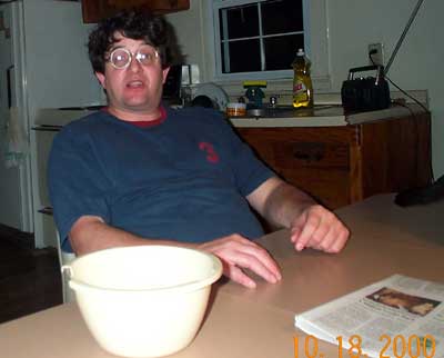
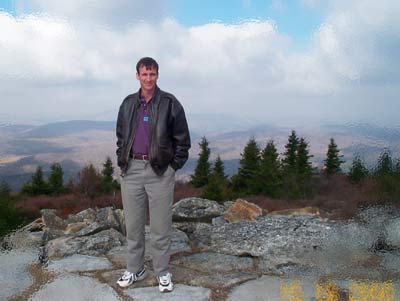
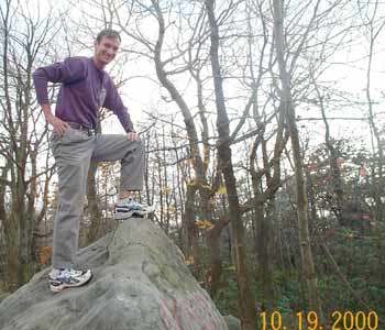
 Laila thought she would be funny by taking the last pic of me. Har-de-har.
 This region of PA was bypassed by settlers because of its inability to be effectively
cultivated.
This region of PA was bypassed by settlers because of its inability to be effectively
cultivated.