At 13, 988', Grizzly Peak is the highest thirteener in Colorado. It also has the distinction of being the highest of six ranked 13er's with the same name. It's not an easy climb at any time of the year, but early winter is probably the most challenging.
I had taken the week off in between the Christmas and New Year's and was anxious to have it out with the mountains once again: Sam and me against the elements.
I got on the road from Colorado Springs on Monday, early afternoon, reaching the trail head at South Lake Fork Creek around 3:30 P.M. Normally you can drive 3.3 miles up the dirt road (or 4.5 miles with a 4X4), but this time of year the road is closed to all but snowmobiles.
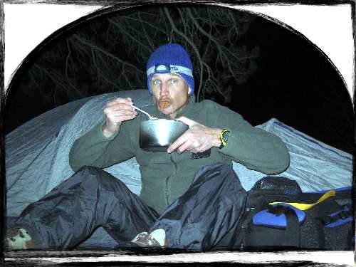
Since at this time of year the sun goes down by 5 P.M. I quickly put together my pack and began trudging up the snow-covered road. A couple groups of cross-country skiiers were returning from a day's outing, leaving a nicely packed surface. They were all surprised when they realized I intended to camp out that night. "Where are you going to set up camp?" One asked me. "I don't know yet! I'll have to look for a site!" I hoped to just get past the first mile and a half of the road, since that lies on private property. The next skiier asked incredulously "Why are you camping out??" I simply said I had done it many times. Soon I found a nice bare spot under a tree before dark and set up the tent and prepared dinner.
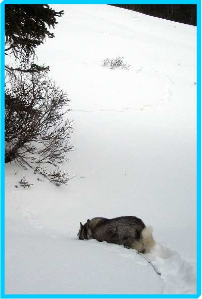
After the sun went down the nearly full moon lit up the sky--the wind eerily calm and the silence complete I savored the moment. Sam was off "freelancing" as I call it.
I sleep on my side and the Thermarest pads just aren't soft enough. In the tent I sleep on one side until I wake up in pain, then turn to the other side, and repeat until I think it's close to dawn. The first time I checked my watch it was 12:30. Then came 2:15, 3:05, finally 5:15 and time to wake up. I read for an hour before beginning the laborius process of pulling on clothes while avoiding leaving the warm bag. By 6:45 under still moonlit skies we were hiking.
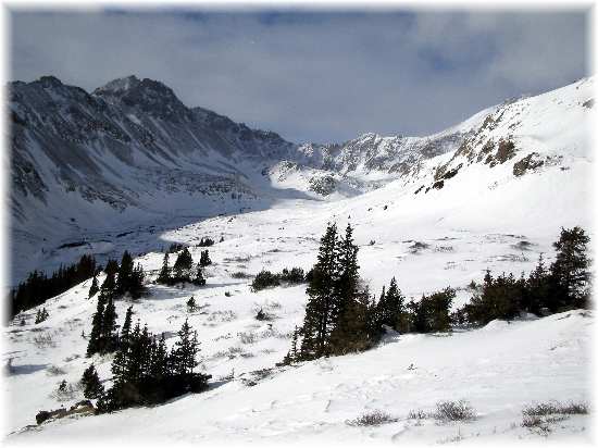
The nicely packed ski tracks ran out after two miles. From here on we broke trail. I had forgotten why it's not a good idea to climb this early in the winter -- the snow has not had enough freeze-thaw-freeze cycles yet and is too loose and unconsolidated. Even with snowshoes I sank 6-8 inches with every step and often even deeper. Very hard work.
Three hours later and we had only reached the 4-wheel drive parking lot, 4.5 miles from the car and three miles from our camp site--a slow 1.5 miles an hour. Behind a gate the road continues for 1.2 more miles, but I didn't make it to the end.
No, I inadvertently diverted from the road when I noticed a pole with an orange banner on it. Thinking that would be where the road led I aimed for the pole. Unfortunately any semblance of a road quickly disappeared and we were plunged into the woods.
No worries. I simply kept tracking SSW up the valley. The guide book stated that after 1.2 miles, turn right at a fork in the road for .2 miles to an abandoned mine, then gain the saddle to the right of Grizzly. I reasoned that angling up the slope of the ridge as continued SSW would put me square with the mine.
Not quite right. You see the ridge line may remain fairly straight, but the lower slopes contours with every fold. I found myself covering a lot more ground than if I had stayed lower and remained on the road. The deep snow only added to my miseries.
No less troubling was that I had forgot to bring ski poles for balance. Also I had gulped my last swallow of water about two hours into the day. All I had left was an apple for fluid--that and snow.
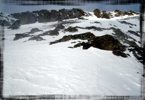
Boxed in against the side of the mountain I couldn't get the big picture--Grizzly wasn't in sight. Consulting the topo map I made a judgement call and decided to go for the ridge. At least I'd be able to see Grizzly and hopefully traverse the ridge to the summit.
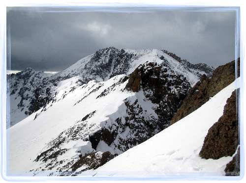
Time was moving along and I wasn't making good speed. I decided my turnaround time would be 1 PM. Ascending in loose snow with no poles was excruciatingly difficult and slow. I wanted to quit, but I could think of no good enough excuse so I kept going--setting my sights on way points and making small goals--such as a band of rock. One band of rock pictured three photos up on the left looked problematic. The snow gulley looked too steep. Could I find a way up on the rock? Climbing right up the tock just to the left of the small couloir revealed no easy route so I backtracked and went to the right of the couloir. It appeared that I could climb up onto the rock and that there was an initial flat spot where I could remove my snowshoes.
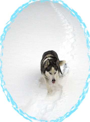
Once I reached the "flat spot" it felt too precarious to linger and I was forced to continue clamboring up the rock in full regalia--snowshoes and all. Making good and certain of every hand and foot hold I slowly made my way past the obstacle. Meanwhile, Sam wisely decided to wait at 12,500'.
Above rock band was another long expanse of steep snow leading to the final ridge. I had an increasingly bad feeling about the climb, particularly after I set off a small slab avalanche that broke off right next to me. I tried to stay next to exposed rock or on windswept consolidated snow as much as possible.
When I finally reached the ridge it was 1:15. My Suunto altitude watch read 13,740'--the highest I would reach on this day. Grizzly was too far away and besides the ridge looked too hairy to climb in the wind and with the scary snow cornices. It would have taken hours. So, happy that I had made my best effort I turned back--not without some trepidation. There was still the avalanche danger to contend with.
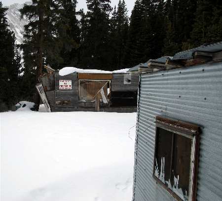
Descending went much faster than going up of course and soon I reached Sam--right where he'd quit, patiently waiting for me. Instead of retracing our steps we descended all the way downslope, finding the road we had lost earlier in the day. We passed the ruined buildings of Stewart Mining Co. The same company who apparently rendered the creeks in the valley undrinkable according to signs posted along the road.
Still, when I heard the babble of running water I searched out the source and drank my fill. It was just a small creek and up valley from the operation I reasoned. It's mostly snow meltoff. Can't harm me. (Gulp!)
We reached the camp site before 4 P.M., in time to break camp and make it to the car before dark.