
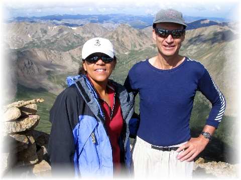
A couple of weeks ago a friend invited me to come along on a climb of Mt Elbert. Since Rebekka has been bugging me to take her on a climb of Colorado's highest point. Since I have insisted on dragging her along with me on my obsession to climb the state highpoints, why hadn't I brought her to our state's highest point? I had no real reason other than that I'd already climbed it five times and now that I've completed the 54 14er's in Colorado I'm now trying to get the highest 100 peaks.
A quick look at the topo revealed a good way to satisfy two goals. I suggested to my friend that we climb Elbert's west face, then traverse north to Bull Hill (this segment I've done three times previously) then traverse the ridge from Bull Hill to Casco Peak, one of the highest 100 peaks in Colorado and return via Iron Mike Mine and North Halfmoon Creek Road. His friend coming from out of state only wanted to bag the highest point of Colorado by the easy trail though, so Rebekka and I set our plans in motion to do it "our way".
I got off a little early from work that Friday and we started for the Halfmoon Creek Road just south of Leadville about 5 P.M. from Colorado Springs. I joke that it's always 2 and a half hours to most mountains from Colorado Springs and that was about right this time as well. Nine miles up the Halfmoon Creek Road a rough 4-W drive road branches left and crosses the creek. This is where I parked my Honda Accord and set up the tent for an early start on Saturday.
Next morning we crossed the creek, keeping our feet dry by scooting along a log, and were trudging up the road by 5:45 A.M. The last time I had been here was summer of 2003 when I did a halfhearted three mountains of the "unofficial" and last run of the short-lived Nolan's 14 Adventure Run. After a mile or more there is another stream crossing--this one much more difficult than the first. This is where I parked my truck in 2001 when Mike Trevino and I attempted nine 14er's in 24 hours. Another couple miles or so and we came on a rather large cairn. This was our cue to angle east cross-country directly to Elbert's West Face, with it's two steep ridges that go directly to the summit.
Actually, the left ridge leads directly to summit. The right ridge comes out a little to the right of the summit. All three times that I'd previously climbed this route I had gone directly to the drainage between the two ridges and muscled up the steep gravelly slope to gain the right ridge. This time however wanting to see if there were an easier way, we continued below the face, angling right across the boulders. When we finally were forced to go for the ridge it wasn't any easier and we'd wasted over half an hour picking our way across the boulders.
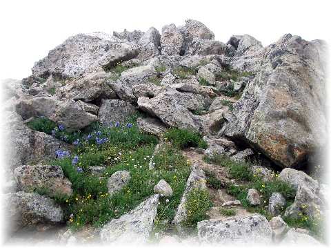
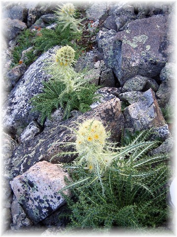
I'm always amazed at the many forms of life up on the slopes of these mountains. Little picas (small mouse-like creatures), bumblebees, wonderful flowers, snow ptarmigans, to name just a few.
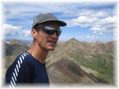
The climb up the West Face is steep and unrelenting. We reached the top around 1000 A.M. and greeted some 20 to 25 climbers who had come up the "easy way" -- one of two trails from the east side. We didn't linger long. We headed north in the direction of Bull Hill and left the crowds behind for good.
We were hiking today, but I well remembered this traverse from both my 2001 11 14er effort in that year's Nolan's 14 Adventure Race (when we ran across the high tundra) and my attempt at 9 14er's that same year (when we picked our way across the rocks in the pre-dawn). Soon we were at the halfway point and in the angle of the ridge, Bull Hill.
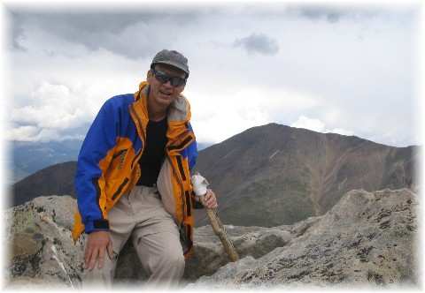
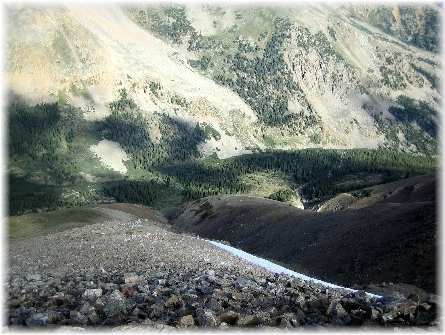
The final ridge walk from Bull Hill to Casco Peak was on unknown terrain. The guidebook, Gerry Roach's "Colorado's Thirteeners" didn't have it as one of its routes. Indeed there was no "climber's trail" and no evidence that much of anyone had gone this way. We did see a lot of evidence of bighorn sheep, but surprising no actual sheep. The ridge had a fair share of false summits and the going was rather tricky in places. This steadily wore poor Rebekka down and once we were in the final saddle below Casco she opted to wait for me while I made a mad dash for the summit. It was late in the afternoon and we had been warily eyeing distant storms on neighboring peaks. On Casco's summit I felt the first snowflake.
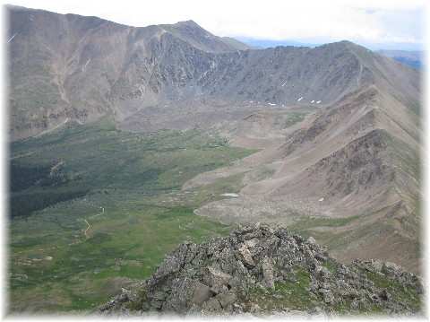
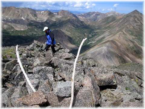
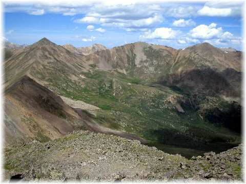
I rather enjoyed Casco's solitary summit (see below for a shot of it). It's rocky and airy. The view from its heights is unique and shows a lot of wild country, extending to the Elk Range to the West, the Gore Range to the North and the southern Sawatch far into the south.
I rejoined Rebekka and we started down into the basin for the long trek back to the vehicle. By the time we rejoined the road the wind had whipped up and a light rain had commenced. We passed a couple rugged 4-W drive rigs bouncing up the road. One of them stopped and the driver asked me "Is there a lake up here?" I told him no, but that there was a nice old mine ruin (Iron Mike Mine at 12,000'). Afterwards I thought it strange that someone would be driving that far into the mountains and have no clue what was back there--no map at all--just driving into oblivion. Strange.
Both of us were leg weary after some 11 hours of walking, so once we finally arrived back at the car we made a simple package of Lipton Mexican Siesta Rice and crawled into the tent just before it got dark. There we slept the sleep of the just and drove back the next day.