Natalie Bremner:
Sunday, March 26th, 2000
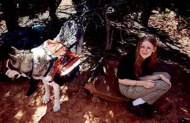
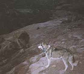
Today started when I woke up. You see, yesterday early morning we left our home (my dad and I) for Southern Utah. It was a nine and a half hour drive from our home in Colorado Springs. When we got to Kane Gulch Primitive Area we camped out at the trailhead. So today we web to Blanding (a town) to get water, a notebook, batteries (for my mini-flashlight)) and gas. We went to get our permit and it only took approximately twenty minutes from there to get to the trailhead. We loaded up dad's big blue pack, my big brown pack and Sam's (our wolf) miniature orange doggie pack.
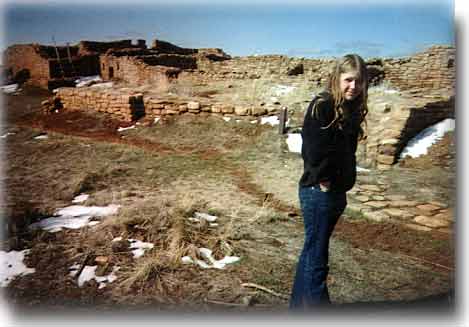
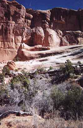
We headed down to Fish Creek Canyon, then down and into the canyon and set down our packs. Oh-and by the way-we went to Butler Wash, an Anasazi ruin sight. It was amazing! So anyways--we put down our packs and hiked a little and my father inspired me to climb the canyon wall to see some cool Anasazi ruins. (He is very good at climbing) He told me that if I had confidence that I could make it. He is cool!
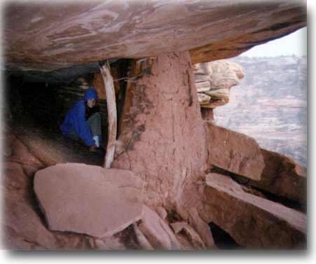
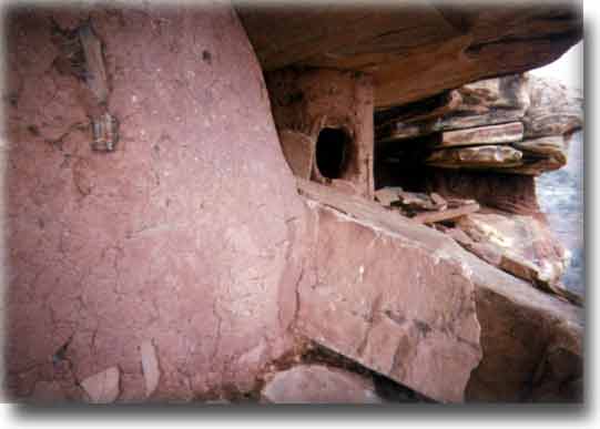
Sure enough we saw what I assumed (and so did daddie) was a small grainery. We went inside to discover a nice, shady (the sun was insufferable), cool area the Anasazi made over 700 years ago. Inside it was pretty dark, but we managed to point out a few small corn cobs left over.
We went and set up camp and Dad went scouting for more ruins. In the meantime while I was eating a Balance Bar, Sam came and bit me for it. Dad came and whacked Sam.
Then he told me he had found something, so we went scouting for it. Me in the background repeating, "I have confidence, I have courage." We saw a home and some pieces of broken pottery.
We then went back to our camp site and made dinner (spaghetti with pasta sauce).
A beautiful creek runs between the canyon walls (Fish Creek). We made some hot beverages, tea for my dad, and hot apple cider for me, then headed straight for the tent because, believe it or not--we all have a bigger day ahead of us tomorrow. Maybe bigger than today. Well, I need to pass this on to Daddie before he falls asleep.
Steve:
I think the Trails Illustrated map of Grand Gulch is inaccurate in its marking of the trail into Fish Creek Canyon. I'll verify this tomorrow with the compass, but I'm pretty sure it shows the trail entering the canyon to far to the left. After dropping into the canyon we came on quite a nice pooroff pool.
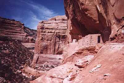
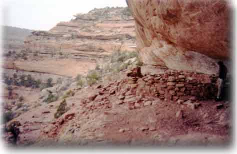
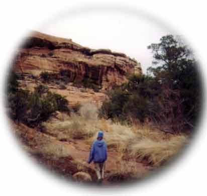
Dropping our packs we backtracked up the canyon, turning left where two canyons converged. The trail was good enough at first, but soon deteriorated so we scrambled along the creek bed. After a few hundred yards up this left canyon I spied a pile of rocks that looked like a ruin. We angled up the side of the canyon wall looking for a good way up there. Finally after some time we manuevered our way up canyon to an easy enough route to the ledge system containing the ruin.
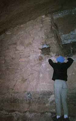
Making our way back to the ruin was not easy though and finally I told Natalie to wait while I sought out a good route. When I reached the ruin I saw that it was well worth the effort--a small nearly perfect granary with an intact door, and to the side the pile of rocks I had spied from below. Natalie made it with some coaching over an easy slickrock section.
Day Two. 27 March 00 Steve:
It turns out that I was wrong yesterday--the map is accurate. A short ways further down the trail we found the confluence of Fish Creek.
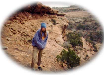
After a late start this morning after awaking at 6:15 A.M. We took extra time to make oatmeal for breakfast followed by a scramble up the south side of the canyon. I had started to scout for ruins when Natalie asked if she could come along. We got up pretty high and Natalie gained some confidence, but once up on the "ledge" we didn't find anything.
After striking camp we only went for about fifteen minutes before we came on Fish Creek joining our canyon from the left. Dropping our packs we sauntered up the pleasant creek bed--mostly on slickrock with a couple minor boulders to scramble over.
Once we reached the fork of the South fork and Fish Creek main canyon we spotted some great ruins high on the right side.
Day 3, 28 Mar 00, Natalie:
It rained a lot last night. We woke up late. Today we saw two nicely made ruins. We had started to hike up McLoyd canyon, but decided to just go back up Owl Canyon because of the rain. I had fun but I got muddy in the rain.
After setting up the tent for the night we ate supper: bagged or freeze-dried food. I had Turkey Tetrazzini and dad had Mexican Style rice and chicken. Then we played.
I was on a long journey--I climbed a mountain, swam across a river, dodged the clinging tree, swang my way up into a waterfall on a vine, walked across a desert and helped Daddie. We went through the petrified forest running away from the vicious beast--which was Sam--only discovering some magic beans. Daddie picked the beans up and said, "I want to control the beast." He saved all the people! Then he entered the Knight bus while I fought a troll for a wafer. All the village people cheered as we rode away to dream world.
P.S. We got rewarded for our herotage.
P.P.S. Daddie did almost all the work--for instance--who did I save? No one. He saved everyone (applause).
Day 6, 1 Apr 00, Steve:
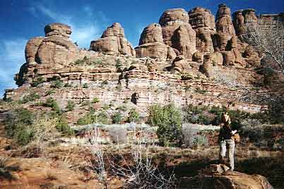
Yesterday after camping up on the mesa we left around 9 A.M. for Road Canyon. The trail from near the road to Cigarette Springs reaches the very end of the canyon in only ten minutes walking time. The trail is easy, unlike the descent into Owl and Fish Canyons. Often it went down the slick rock in the center of the canyon. We saw one large paw print--could have been a bear or a mountain lion. I saw it the previous afternoon when I went on a 20-minute recon run into the canyon.
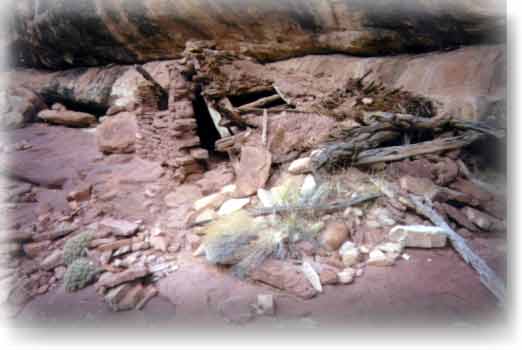
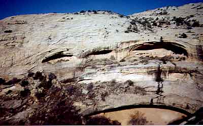
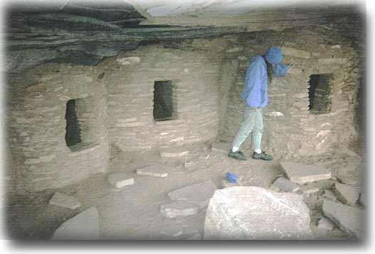
After a short time we saw our first ruins. They turned out the be the cover photo ruins from "Canyon Hiking Guide to the Colorado Plateau". The way up was easy enough following a short ten-foot rock climb. We had a more difficult downclimb about 10 minutes before from a high route above the stream bed. Sam got "owl eyes" for that one, but he made it.
The ruins consisted of three well preserved rooms with a few corn cobs on their floors.
After returning to the canyon floor and turning the corner we spied some more ruins high on the canyon wall. With no obvious way up we backtracked, climbed to the "cover photo" ruins and traversed around the high ledge to reach them.
Over the next two hours we noted three more sets of ruins high on the walls. Finally at our furthest point down canyon we climbed up to to a ruined kiva, looked all around for the "seven kivas" that were supposed to be in this area, but had no luck finding them. I think we had passed them. We were tired so we began the long trek back. It snowed lightly and the temperature stayed near freezing.
Near the first ruins we'd seen that morning we spotted a ruined kiva on the next lower level. The kiva had a collapsed roof, but the method of construction was plain to see.
Back at camp we cooked up risotto rice with Ry-krisp. The snow fell lightly without sticking.
Afternote:
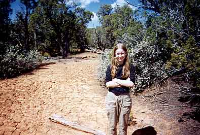
The next day we hiked up South Mule canyon under sunny skies.
That afternoon we checked into a hotel in Blanding, followed by visits to the Cedar Mesa Museum and "Huck's Anasazi Museum." A great end to a magical trip.
Day 5, 30 Mar 00, Steve:
After the third day of rain showers, day four began with glorious blue skies. We left our camp site by the "magical rock" hiking up Owl Canyon. An hour of hiking brought us to Neville's Arch. According to one of my guidebooks there were supposed to be some ruins to the left of the arch. Leaving our packs below, we all began scrambling up the loose rock, trees, bushes and slickrock towards the arch. Our real goal being the ruins rather than the arch itself. However, after thoroughly investigating each level we came up empty. I turned to the arch, which was an easy scramble from the height we had already reached. At first Natalie waited, but then she came on up. The view extended far down Owl to Fish Canyon, with Comb Ridge in the distance.
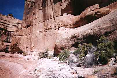
We returned to our packs and tarried to wash our hair before starting up canyon again. An hour up trail we came on the first of three pouroffs.
I noted a route up, so we scrambled far to the right and up broken rock and slickrock. Once on the level of the ruins we made our way across some "airy" slickrock. I had Natalie wait since I don't think she is ready for that level of difficulty quite yet. It was easy walking--just "airy". I was only able to get within fifteen feet of the main ruin--a fortress-like wide expanse of three structures with three windows about 35 feet in total breadth. A further 30 feet along the ledge was a smaller solitary room--likely a granary.
There was a way up to the structures, but since Sam had followed me I didn't go--I didn't want to tempt him into attempting something beyond his abilities. Getting down involved some skill and problem solving, culminating with skirting above cliffs before we came on the logical route to the canyon floor.
Soon we were hiking with the pack burdens once again. After some time we looked left to see more ruins high above. I told Natalie, "I'm not going to make you go up there." But truthfully I didn't think it looked possible! They were way up there!
We passed a party of four with two dogs--fortunately Sam was on leash lumbering along like a pack mule with his wolfpack. This trip he's pulling his fair share.
Continually looking right we still failed to see the "natural arch". I'm certain we passed it. Around 12:30 P.M. we stopped for a siesta and I read a chapter of "Sacred Land, Sacred View" on the Navaho sacred mountains out loud to Natalie. Meanwhile Sam thrashed around in a pool, diving down and around some large boulders. He came back soaking wet and proceeded to shake all over us. Later we set up camp on a sandy spot by the creek around 4:30 P.M.