The next morning I hiked the rest of the way in to the glacier lakes and set up my tent before setting out for Mt Despair.
| After climbing Mt
Shuksan in the morning, I drove two hours to the trailhead for Thornton
Lakes and was on the trail by 6 PM. I hoped to make to the lakes five miles
up the trail, but with darkness rapidly closing in I set up camp by a creek
about four miles in.
The next morning I hiked the rest of the way in to the glacier lakes and set up my tent before setting out for Mt Despair. |
|
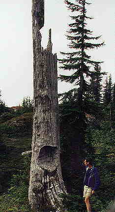 |
I believe this gouge in a spar near where I set up my
tent was from a bear. I saw no signs of bear around lately though.
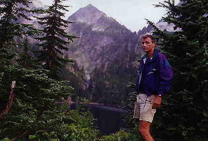
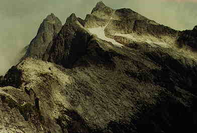
When I reached the lakes that morning I noticed a tent, but never saw anybody during these two days. A climber's spur trail led upward above the three glacial lakes, eventually culminating on a ridge high above the third highest lake. Routefinding at that point was not easy. I had to backtrack at one point after reaching a impassable point dropping off 1000 feet to the basin below. |
| Eventually I reached a col where I could descend into the basin on
the other side of the lakes. My interim goal on the way to Mount Despair
was Triumph Pass. After dropping 500 feet midway down into the basin I
traversed across blueberry fields. I was slowed by willow brambles and
also by the temptation of thousands of the tasty berries.
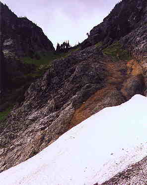
Finally after tough going through the thickets, I decided to drop all the way down into the basin via a waterfall. At first it looked too precipitous, but as I descended it turned out to be an easy enough descent down a series of ledges.
|
 |
 |
 |
|
|
|
| I had a hard time judging the best course to reach Triumph Pass. Electing
to stay high I thought I could see a ledge extending to the pass. The climb
up turned out to be hairier than I'd thought, and the ledge ran into an
impassable spindly waterfall. When I backttracked I soon realized I was
in a difficult situation. Going down is much harder than going up. The
footing was unsure and it was getting late. I took my time and eventually
got out of it. At that point I saw my easiest route would have been to
have descended all the way into the bottom of the basin and then up a grassy
slope to the pass. But by now it was too late. I would have to hurry to
get back before dark.
On the way across the blueberry slopes I saw a mama black bear and her two cubs scampering down the mountain. Darkness came shortly after reaching the climber's spur trail leading to my camp site on lower Thornton Lake. I lost the trail in the ensuing darkness, and would up crashing down the slope grasping fir trees, eventually stumbling into camp around 9 PM. |
 |