Ascent
of Gannet Peak
Wind River Range, Wyoming
July
26th, 27th, 28th, 2000
by
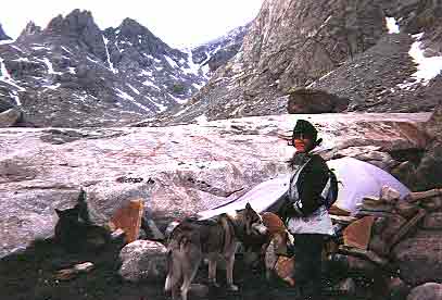
Steve Bremner, Laila Hughes
Sam
the Wolfdog, and Sir Vidia
I've long had
my sights set on climbing Gannet Peak, at 13,805 feet the highest point in Wyoming,
but never have been able to find an adequate description of the fastest route.
One guide book describes coming in from the northeast on the Glacier Trail,
but to reach the trailhead requires at least two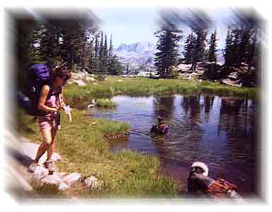 extra hours of driving, and the trail is longer as well. At fifteen miles, the
trail in from Elkhart Park to Titcomb Basin is the fastest route in to proximity
of the peak, but the only description I had of the route from there was a vague,
"If climbing from Dinwoody Pass you can avoid elevation loss by turning Gooseneck
Pinnacle to the south". It didn't say that you had to lose 2,000 feet of elevation
anyway!
extra hours of driving, and the trail is longer as well. At fifteen miles, the
trail in from Elkhart Park to Titcomb Basin is the fastest route in to proximity
of the peak, but the only description I had of the route from there was a vague,
"If climbing from Dinwoody Pass you can avoid elevation loss by turning Gooseneck
Pinnacle to the south". It didn't say that you had to lose 2,000 feet of elevation
anyway!
Though Gannet
Peak is the highest point in Wyoming (30 feet higher than Grand Teton) it is
not visible 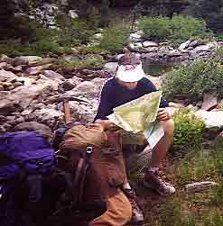 from
outside the wilderness. You have to pay your dues just to get far enough back
there to even have a view of it!
from
outside the wilderness. You have to pay your dues just to get far enough back
there to even have a view of it!
I had planned
on allowing four days for the expedition, but after running the Salt Lake City
Marathon on Monday, the 24th, and with the race starting at 5 A.M., I decided
to just relax the rest of the day and leave on Tuesday from the city instead
of that afternoon.
It should have
been a four hour drive, but we decided to make a run for supplies to Hill Air
Force Base. A mistake. The money we saved was lost in lost time and gas as I
made a couple of wrong turns going to the base and trying to get on the road
again to the mountain range.
We finally
arrived close to the Elkhart Trailhead about an hour before dark on the 25th
of July. There is a campground there,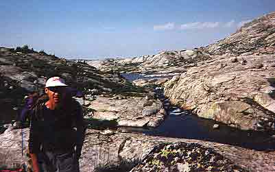 but I avoid them when possible, so we just drove down a dirt road a ways and
set up the "big tent" complete with deluxe large blowup mattress. When car camping
do it in comfort!
but I avoid them when possible, so we just drove down a dirt road a ways and
set up the "big tent" complete with deluxe large blowup mattress. When car camping
do it in comfort!
The next morning
we were not exactly up at the crack of dawn. I was up at about 6 A.M., but I
let Laila sleep for nearly two more hours before I told her we had better get
going! By the time we had put together our packs and were actually hiking it
was 9:40 A.M. So much for an early start.
The parking
lot held about 70 cars, but when we checked the register no one had signed up
to climb! We found a lot of backpackers, and to our chagrin TOO many horsepackers,
ripping up the trail and providing all too easy access 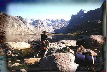 to
a pristine land to dudes and dudettes. They left a lot of destruction in their
wake in the form of muddy trail segments and considerable horse droppings. To
see those people loading up their horses with everything to make for a home
away from home and not even troubling themselves with a lick of exercise...just
going along for the ride...was troubling. Just another example of "multiple
(ab)use" of our public lands.
to
a pristine land to dudes and dudettes. They left a lot of destruction in their
wake in the form of muddy trail segments and considerable horse droppings. To
see those people loading up their horses with everything to make for a home
away from home and not even troubling themselves with a lick of exercise...just
going along for the ride...was troubling. Just another example of "multiple
(ab)use" of our public lands.
The trail
begins climbing through pine forest, but after only about three miles reaches
high alpine country at about the 10,000 foot elevation level, where it stays
for the next twelve miles. Absolutely gorgeous country with expansive views
extending to the continental divide and many alpine lakes. We passed among others,
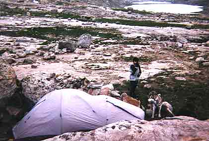
the very large Seneca Lake, then Island Lake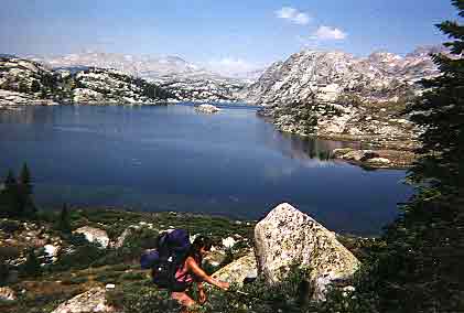 (a popular camping site), eventually reaching the first of the two large Titcomb
lakes. Finally after nearly eight hours of hiking we found a camp site above
the two lakes in Titcomb Basin. It was nestled up next to a large rock with
stones piled up as a windbreak on two other sides. At the time we figured it
might be prudent to take this cue that it might get windy at times. That night
we would be glad we had chosen the ready made shelter!!
(a popular camping site), eventually reaching the first of the two large Titcomb
lakes. Finally after nearly eight hours of hiking we found a camp site above
the two lakes in Titcomb Basin. It was nestled up next to a large rock with
stones piled up as a windbreak on two other sides. At the time we figured it
might be prudent to take this cue that it might get windy at times. That night
we would be glad we had chosen the ready made shelter!!
 |
 |
After we had
cooked up dinner and settled into the tent the wind started to pick up and then
the rain started. Then for hours thunder crashed and lightning lit up the night
in a hellacious storm. The tent's rainfly flapped like you see in the movies
of Mount Everest. We stayed dry though and I became a devoted advocate of the
Quest fifth season tent that has done me right for some years now!
I slept through
my wrist watch alarm the next morning, awakening naturally at 5:20 A.M. We were
getting a later start on the mountain than I had planned on.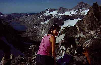 It was 6:10 A.M. when we finally started up the basin towards Dinwoody Pass.
Black clouds threatened from the east above the divide. By 6:30 I saw lightning
up on the peaks, then the wind kicked up and it started to rain.
It was 6:10 A.M. when we finally started up the basin towards Dinwoody Pass.
Black clouds threatened from the east above the divide. By 6:30 I saw lightning
up on the peaks, then the wind kicked up and it started to rain.
We got behind
a large rock and just hunkered down to see what the weather was going to do.
I thought our climb might be over. Twenty minutes later the rain had ceased,
and blue sky to the west was winning the battle with the black clouds from the
east. We pushed on.
The day before
we had passed an older gentleman, "a guide" for some of those "easterners" using
llama pack animals. He told us the "crux" of our 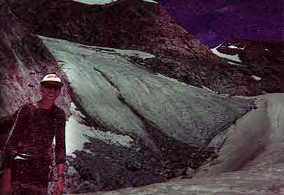 climb
would be reaching Dinwoody Pass. I didn't believe him. As it turned out the
2,000 feet elevation gain to the pass was an easy snow climb. Crampons and ice
ax made the work easy.
climb
would be reaching Dinwoody Pass. I didn't believe him. As it turned out the
2,000 feet elevation gain to the pass was an easy snow climb. Crampons and ice
ax made the work easy.
With the pause
for weather and fiddling with Laila's strap-on crampons it had taken us three
hours to get to the pass though. We noted two tents at the pass. I wondered
what kind of night THEY had passed. Looking far down to the northeast we saw
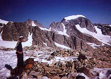
them, six climbers making their way across the Dinwoody Glacier.
At this point
I realized we were going to have to lose about 2,000 feet of elevation, then
follow them to the right of a monstrous palisade extending down from the ridge.
 The
course they followed led up a thin bridge of white snow in between two dirty
patches of old glacial pack. As we crossed the glacier towards the bridge we
passed a couple of crevasses. They were not "gaping" and were easy enough to
avoid, but they are still crevasses and deserving of respect!
The
course they followed led up a thin bridge of white snow in between two dirty
patches of old glacial pack. As we crossed the glacier towards the bridge we
passed a couple of crevasses. They were not "gaping" and were easy enough to
avoid, but they are still crevasses and deserving of respect!
Turning the
corner around the rock buttress (palisade) we climbed up mixed rock and ice
before going on glacier with more crevasses to skirt. Again they were not the
formidable crevasses I'm more familiar with from Washington state's Cascades.
Suddenly we
heard a terrible crashing sound from just above us. We later learned it was
a boulder twice the size of a basketball that had crashed down amidst the six-person
party just ahead of us as they ascended the crux of the 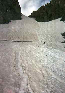 route,
a very steep couloir to the left of Gooseneck Pinnacle. As the couloir came
into view we saw their party was nearly to the top of it. Still, it looked very
steep and I briefly considered going around further to the left of a rock buttress
and gaining the ridge. A quick look at the topo however showed that this was
the only way up. It was only about 400 feet high so we just started up it. This
was Laila's first time using crampons, so I showed her how to "frontpoint" and
use her ice ax as a climbing tool. We didn't have a rope, but there was really
no effective way to "protect" it anyway as it was a straight shot up the snow.
I slipped once, but was able to self arrest pretty quickly, so it wasn't all
that dangerous. Still, since we'd brought them along this far we donned our
helmets. The dogs managed fine, though Sir Vidia was a pain in the @#$ as he
stayed too close to Laila.
route,
a very steep couloir to the left of Gooseneck Pinnacle. As the couloir came
into view we saw their party was nearly to the top of it. Still, it looked very
steep and I briefly considered going around further to the left of a rock buttress
and gaining the ridge. A quick look at the topo however showed that this was
the only way up. It was only about 400 feet high so we just started up it. This
was Laila's first time using crampons, so I showed her how to "frontpoint" and
use her ice ax as a climbing tool. We didn't have a rope, but there was really
no effective way to "protect" it anyway as it was a straight shot up the snow.
I slipped once, but was able to self arrest pretty quickly, so it wasn't all
that dangerous. Still, since we'd brought them along this far we donned our
helmets. The dogs managed fine, though Sir Vidia was a pain in the @#$ as he
stayed too close to Laila.
When we reached
the top of the snow gulley one of the first party had decided not to continue
to the summit. She had had enough. As it turned out the hard part was over though.
We took off the crampons for a short rock scramble to the final easy ridge walk
on snow. 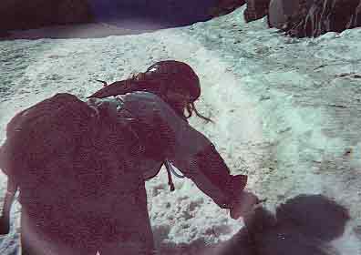 The
slope was easy enough to leave the crampons off. We caught up to the party ahead
of us just as they reached the summit. It was after 1 P.M. by that time and
I was worried about being caught in weather so we didn't stay long on top.
The
slope was easy enough to leave the crampons off. We caught up to the party ahead
of us just as they reached the summit. It was after 1 P.M. by that time and
I was worried about being caught in weather so we didn't stay long on top.
Sure enough
as we started down the couloir the rain and wind came in. Mercifully, it was
shortlived, but with a lot of high country to traverse our sense of urgency
was heightened. Going down the couloir took an hour and a half as Laila made
extra certain she always had three stable points! It had taken us only half
an hour to go up. I was proud of her though on this difficult climb.
Then it was
across the Dinwoody Glacier again, followed by going up 2,000 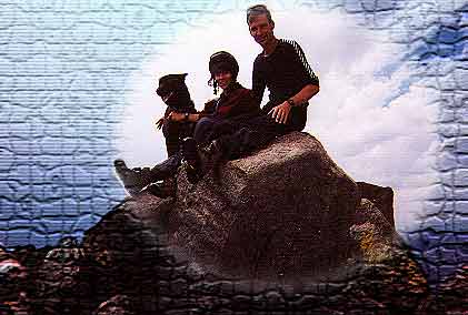 feet
of snow to Dinwoody Pass. We passed the tents at the pass around 5 P.M. with
just a quick word of greeting before we started down to the basin, ultimately
reaching our tent around 7:15 P.M. I was so exhausted my single-focused object
was to get everything squared away so I could get in the bag, cook dinner in
the vestibule, eat, and then "rest my eyes".
feet
of snow to Dinwoody Pass. We passed the tents at the pass around 5 P.M. with
just a quick word of greeting before we started down to the basin, ultimately
reaching our tent around 7:15 P.M. I was so exhausted my single-focused object
was to get everything squared away so I could get in the bag, cook dinner in
the vestibule, eat, and then "rest my eyes".
The following
morning we had a long backpack out ahead of us. Beautiful country, but a long
hard trek. The wilderness is more impressive than anything I've seen in Colorado,
with glaciers and a true alpine setting.
Laila had been
keeping close track of our food supply and had determined that we had to cook
a package of rice-a-roni for breakfast, since we didn't have enough for breakfast
otherwise. We had two extra rice packages. So around 10 A.M. we stopped at a
creek to take a break and cook up the rice. 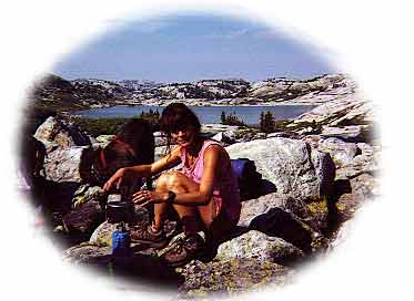 It
takes nearly half an hour to cook the rice package after boiling the water,
preparation, etc. Well, when the rice was nearly finished cooking, Sam the Wolfdog
clumsily knocked it over and we had to start all over again with what was now
our last package!
It
takes nearly half an hour to cook the rice package after boiling the water,
preparation, etc. Well, when the rice was nearly finished cooking, Sam the Wolfdog
clumsily knocked it over and we had to start all over again with what was now
our last package!
This breakfast
break wound up taking us an hour. Then as we rounded Island Lake we accidentally
started up a horse trail, gaining 500 feet of hard earned elevation only to
stumble on a horse camp where the trail ended. An elderly gentleman came out
in one of those "western" shirts, with the string tie and all to tell
us we had lost the trail and would have to backtrack to the lake again. <groan>
If I were
to do this trip again I would have to allow more time for the approach to Titcomb
Basin. 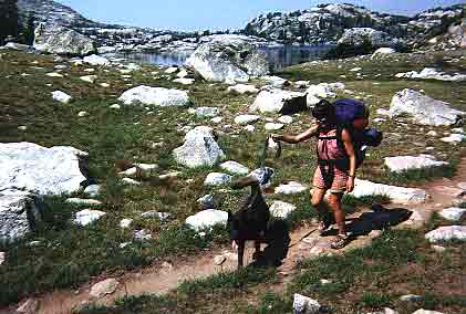
Another trip
in this region I would like very much to do is a 45-mile trail loop run from
Elkhart Park through Indian Pass and to the Alpine Lakes. This run could easily
be done in a day by an ultra-runner. What a great run this would be!
highpoints