Steve Bremner
Oct 13, 2004
39th state high point
I've been dreaming and scheming to climb this peak for about seven years, mostly from my arm chair. While stationed in Ottawa, Canada from 1996-1998 the mountain was close enough to reach in a long days drive. One summer, my son Joe, Sam the Wolfdog and I took a three-week "tour de New England", climbing New Hampshire's Mt Washington, camping on Kineo Island in Maine's Moosehead Lake, and hiking the trails of Acadia National Park. We didn't go to Baxter Park though because of their restriction on pets. The prospect of finding a kennel in the back woods for Sam was more than I wanted to take on at the time.
The next couple of years I plotted a winter climb of the peak. This seemed a formidable enough challenge on which to set my sights. The problem was the park requires four members for a winter expedition. I never quite rounded up the required hardy fools from my Canadian friends, and soon enough I was on my way to Colorado and new peaks and challenges. Katahdin was on the back burner.
As I planned out my marathon schedule for this year I settled on October's scenic Mt Desert Island Marathon in Maine's Acadia National Park. Perfect timing to make a go at Katahdin.
I arrived in Bangor, Maine around 5 in the afternoon on Oct 11th from my home town of Colorado Springs following a full day of flying that began with a connecting flight in the wrong direction to Salt Lake City. From the airport I drove north towards Baxter State Park, 86 miles away. 10 miles before the park entrance and a short ways off the main road I set up my tent. It rained all night.
Next morning one the way to the park the radio broadcasted weather forecasts on the breaking up of a tropical storm coming from Halifax, with wind advisories, 40 MPH gusts, and rain all day. The ranger at the park entrance asked me what my plans were. "Climb Katahdin by the knife edge" He rolled his eyes, shaking his head and advised me to check in with the ranger at Chimney Pond (3.3 miles up the trail) for current conditions, but recommended just going up the easier saddle trail.
Fallen branches littered the road; the rain kept coming. At the trail head I remained in the car a few minutes, waiting for a break in the rain. No respite. Finally I gave up. I turned back, driving to the nearby town of Millinocket.
The "Appalachian Trail Cafe" ("Hikers Welcome!") beckoned and soon I was relaxing with newspaper, coffee and breakfast for under $5. Small town America is great!
Millinocket is a nice little Maine town. I soon found out from the local paper it is a bit depressed economically following the bankruptcy of its largest employer, Great Northern Paper. They have an organization with the acronym MAGIC (I forget what it stands for) that is attempting to figure out how make up for the lost jobs.
Wandering around downtown I found an Internet Cafe that allowed me free Internet access with my wireless laptop. Later I found a clean hotel room for the night.
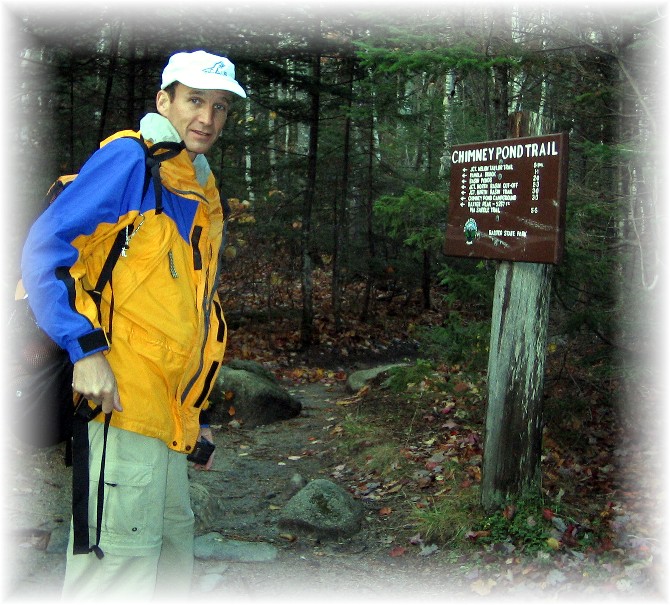
Next morning clear skies greeted me and I was on the road by day break at 6:15 and hiking the trail at 7:00.
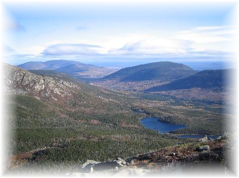
From Roaring Brook Campground, the trail goes a gentle 3.3 miles through forest until reaching the back country camp site at Chimney Pond. This is the only authorized location to camp in the back country for this area of Baxter Park. A couple sleepy-looking people poked around their camp sites. The valley was still in the shadow--it had taken me just over an hour to hike to this point. I glanced at the bulletin board and saw a list of "essential items" to climb Katahdin. When I saw "boots" I thought "yeah, right. I'm from Colorado and I've run up numerous 14er's in running shoes. That doesn't apply to me."
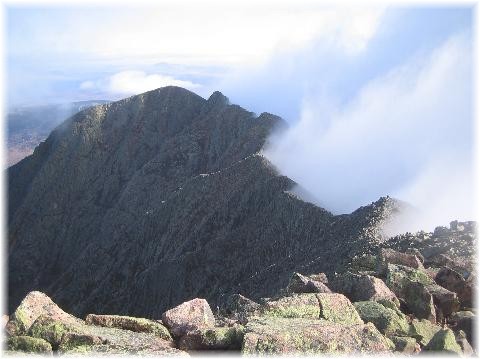
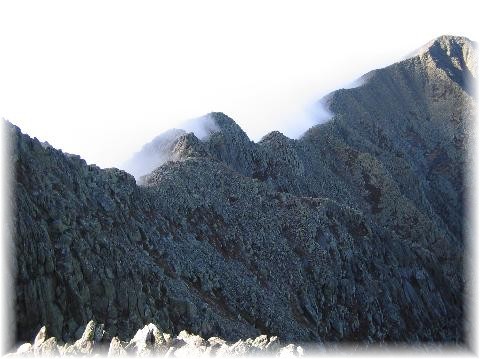
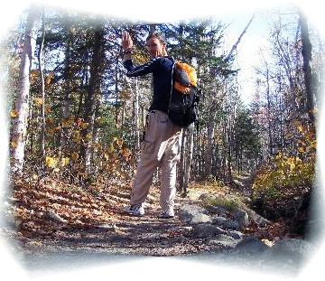
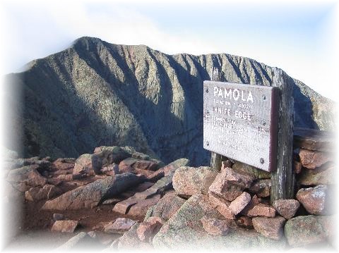
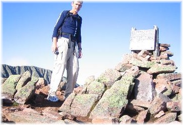
To reach the knife edge I had to make a left turn on the Dudley Trail leading up to Mt Palomar. Immediately the climb began in earnest. There was not much of a trail. Blue paint marks on the rocks marked the way. I quickly realized that boots would make the going much easier!