Longs Peak, 14, 255' 28 Apr 01 Steve Bremner and Sam the Wolfdog, Keplinger Couloir via Sandbeach Lake
I've been trying to get Sam the Wolfdog up Longs Peak for a couple years now. I had already climbed it via the Keyhole Route July 31st, 1999 without him, while Sam and I have attempted it in winter three times; the last time on Feb 21, 2000 trying the same route we had success on today. Last year the conditions were much more extreme, and I had route-finding problems. This time I knew the way. The other two tries on Longs were attempting to go up and over Meeker and assailing Longs from the Loft. Sam the Wolfdog now has completed 51 of the 54 Colorado 14er's under his own power.

Conditions were perfect on this fine spring day. On the summit there was no wind and the temperature 
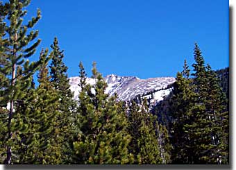
a mild 50 degrees. The route is long and arduous though--5900 feet elevation gain and sixteen miles roundtrip. Snowshoes were required already by 9500 feet elevation.

Sandbeach Lake
Sandbeach Lake
Leaving Colorado Springs at 4 A.M. I was hiking by 6:30 A.M. Though no one had broke trail ahead of us, it was straightforward reaching Sandbeach Lake after 4.5 miles, taking about two and a half hours. Along the way we saw a couple grouse and an elk. I kept Sam on leash below timberline.

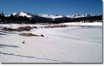
Departing from Sandbeach Lake I veered too far west, instead of due north, and began ascending the left ridge of the drainage leading to a basin surrounded by Meeker, Longs and Pagoda Mountain. I had to lose elevation to get it straight (ugh!) Lost 
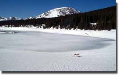
in the woods now I plodded ever higher in deep snow. Sometimes even snowshoes won't prevent post holing. High on a ridge to the east I spotted a couple bighorn sheep likely on "sentry" duty; Sam didn't see them.

Sheep on ridge
Lower Drainage leading to basin

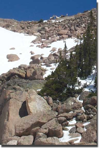
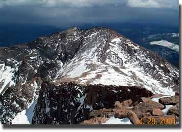
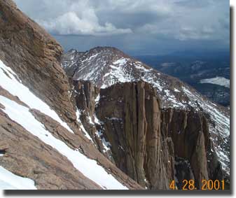
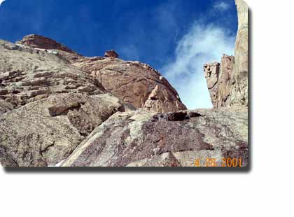
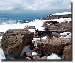
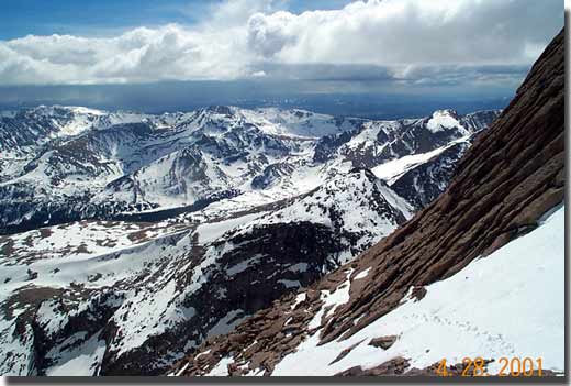
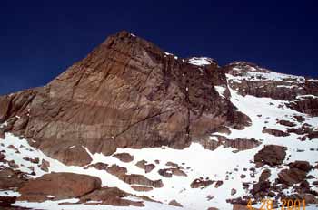
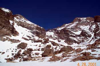
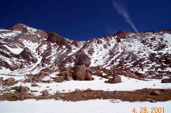
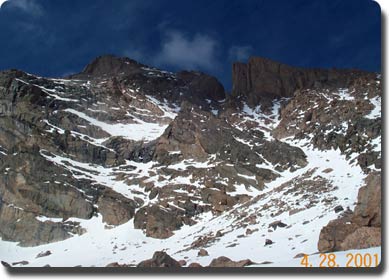
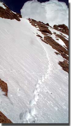
To reach the upper basin we had to maintain a steady bearing north. A prominent palisade below Pagoda was to our left as we ascended into the high basin. Last year I mistakenly ascended a saddle to the right of Pagoda. The correct couloir leads directly up to the "notch". As you look up to right you can see the notch, which separates a palisade of cliffs from Longs actual summit. The correct couloir aims directly at the notch. Meeker's summit is not visible from the basin, while Dragon Egg Rock is far to the right, down the ridge.


Dragon's Egg Rock
View of left side of basin
Middle section of basin (cleft is Pagoda saddle)
Right of basin (Keplinger's Couloir  is seen just right of Longs summit, leading to "notch")
Keplinger's Couloir is long, but not overly steep--a good snow route, which is Sam's forte. Indeed the entire route to the summit, including the final "home stretch" was a snow route. Initially though, Sam hung back as I climbed the couloir. Not until I went out of sight around a corner did he make a quick ascent to join me. Once we reached the end of the couloir at 13,600', instead of going into the notch, we angled left. Gerry Roach's guidebook says, "ascend ledges to connect to the keyhole route". No ledges on this day! Just steep snow. I removed the snowshoes and broke out the ice ax as the exposure was real. The snow was too soft for crampons, so I kicked steps. Finally I saw the familiar bull's-eye marking on a rock from the Keyhole Route. We were now at 13,900' and ready for the final "home stretch".
Keplinger's Couloir to the right side of photo (note notch in middle right , Longs summit to the left)
Homestretch (see cairn at the top right of the end of the snowfield?)
Now there were no bull's-eyes in view as snow had filled in the route. Looking high up to the summit I spotted a cairn. Climbing steadily up the snow slope I was relieved when I reached the cairn and realized this was the summit! I was so proud of Sam I gave him an entire package of beef jerky.

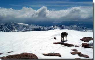
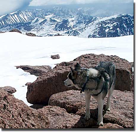
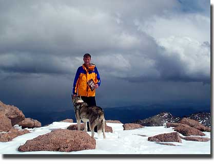
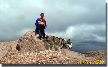
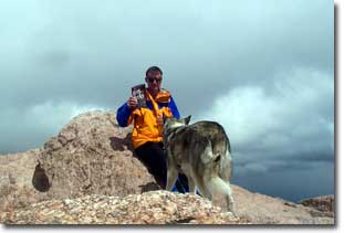
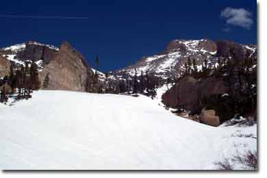
We spent half an hour on the Longs' expansive flat summit. Black clouds surrounded us on distant peaks, while we enjoyed a fine sunny day with nary a trace of wind. The last person to sign in to the peak register had summited on April 4th, though twelve people had summited in March and some in January and February. Longs, it seems is popular any time of year!

In the late afternoon the snow was getting very soft. At first I tried to plunge step down without snowshoes, but this became impossible as I found myself post holing to the hip at times. Even with snowshoes it was far from easy.

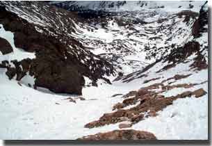
Once in the basin I steered more to the left, keeping Hunter's Creek on my right. I figured that eventually I would run into the trail and probably save time vis-à-vis trudging back to Sandbeach Lake. It turned out to be quite a ways though to reach the trail and the snow was soft and deep. In retrospect I'm not sure this route was any faster. At any rate we were back to the car by 7:20 P.M. for the two hour drive back to the Springs. One long(s) day!

Sam on Longs' flat summit
View towards Meeker; Palisades and loft in foreground.
Clarence Lake to the Northeast from Longs Summit
Sam the Wolfdog on the summit of Longs Peak, 28 April 2001, his 52st 14er in his three and half years on this planet!
Looking down Keplinger's Couloir
Palisades, Meeker in backdrop, photo taken from the bottom of the "homestretch"
The "notch"
Steve and Sam on Longs (note the bribe for the photo--it didn't work)
Bull's eye characteristic of the popular Keyhole route up Longs Peak
Steve and Sam on Longs
The "notch" from Keplinger's Couloir
Sam on Longs
View to the south west from the lower part of the "homestretch"
The 'ole bribe for a photo
Steve Bremner's North American Outdoors
Ascent time: 8 hours
Summit rest: 30 minutes
Descent time: 4 hours 20 minutes