Mt Harvard
and Missouri Mountain
10 Jul 99
By Steve Bremner and Sam
the Wolfdog
 After
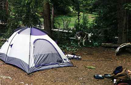
I got off work Friday afternoon I drove straight for the Sawatch Range and
Horn Fork Basin. Arriving early evening, there was enough time to hike up
the trail to where it branched with the choices of left to Kroenke Lake
or right to Horn Fork Basin. I stopped there and next to a rushing stream
set up my tent for the night. After
I got off work Friday afternoon I drove straight for the Sawatch Range and
Horn Fork Basin. Arriving early evening, there was enough time to hike up
the trail to where it branched with the choices of left to Kroenke Lake
or right to Horn Fork Basin. I stopped there and next to a rushing stream
set up my tent for the night.
I'd last been in Horn
Fork Basin in February when I climbed Mt Columbia
in extreme winter conditions.
|
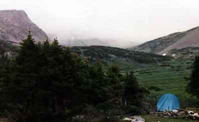 The following morning when I left camp around 0600 carrying only a hip pack
and clad in running shorts I fully expected to return to the tent day's
end. I'd charted an ambitious day that included the summits of Harvard,
Missouri, and Huron, followed by many miles of trail and even bushwacking,
but I had no idea this ordeal of a day was going to last 30 hours.
The following morning when I left camp around 0600 carrying only a hip pack
and clad in running shorts I fully expected to return to the tent day's
end. I'd charted an ambitious day that included the summits of Harvard,
Missouri, and Huron, followed by many miles of trail and even bushwacking,
but I had no idea this ordeal of a day was going to last 30 hours. |
|
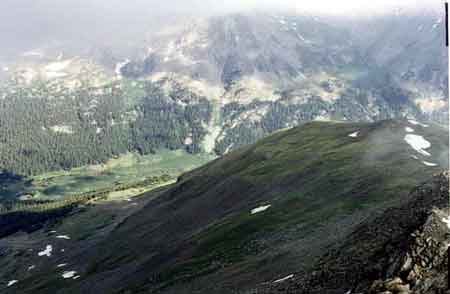
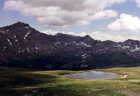
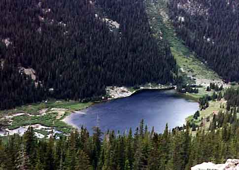
 At
left is the route I took in February up Columbia. Around the prominent
rock to the right, we then ascended the NW ridge looming in the distance.
Of course then there was much more snow. At
left is the route I took in February up Columbia. Around the prominent
rock to the right, we then ascended the NW ridge looming in the distance.
Of course then there was much more snow.
|
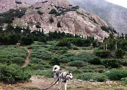
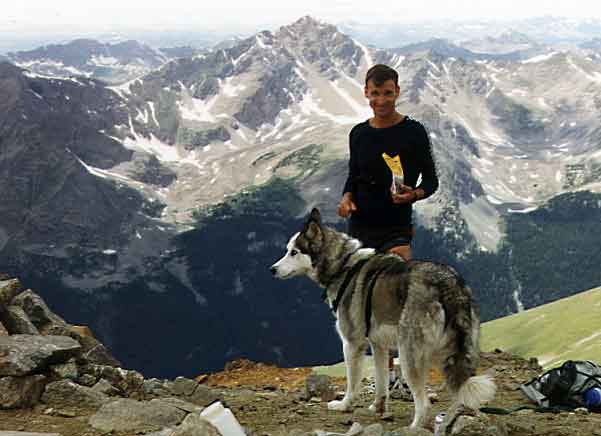
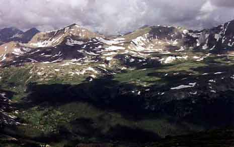
 I followed the trail
up the basin until it disappeared. Cairns mark the easy way, which is to
stay left aiming for saddle. below Harvard to the west. From the saddle
it is a ridge walk until the final summit pyramid which is a bit of a scramble.
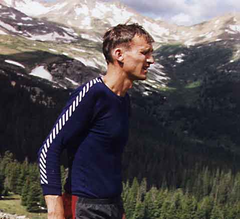
Sam the Wolfdog made it after attaching the leash and a bit of gentle persuasion.
I followed the trail
up the basin until it disappeared. Cairns mark the easy way, which is to
stay left aiming for saddle. below Harvard to the west. From the saddle
it is a ridge walk until the final summit pyramid which is a bit of a scramble.
Sam the Wolfdog made it after attaching the leash and a bit of gentle persuasion. |
|
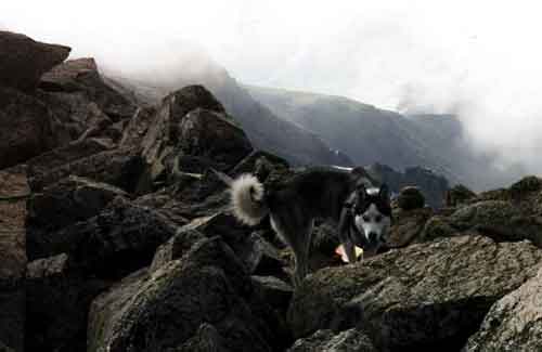
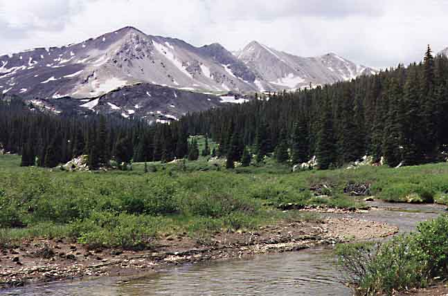
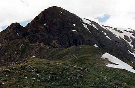
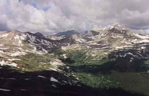
 We descended Harvard
by dropping into Missouri Basin. The ridge walk was a bit tricky in places,
particularly for Sam.
We descended Harvard
by dropping into Missouri Basin. The ridge walk was a bit tricky in places,
particularly for Sam.
Above timberline I
normally allow Sam to run free. I can keep track of him and he normally
doesn't pick up a scent and take off. Unfortunately there was a coyote
lurking right at timberline in the valley as we descended. I saw it before
Sam picked up its scent, but couldn't get to Sam in time. I watched Sam
sniff and track the coyote from about 200 yards away. He still hadn't
spotted him. When he finally did the chase was on.
|
|
 After
waiting for half an hour, I started down through woods towards Missouri
Basin. Sam had gone in that direction and I thought I might run into him
when he'd tired of the chase. After
waiting for half an hour, I started down through woods towards Missouri
Basin. Sam had gone in that direction and I thought I might run into him
when he'd tired of the chase.
Half an hour further
hiking yielded no Sam, so I backtracked to where I 'd last seen him. When
he finally ame I had lost an hour.
|
<
|
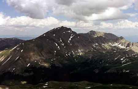
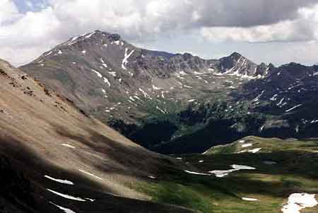 I
found the trail leading up to Elkhead Pass. The ridge from Elkhead Pass
to Missouri's summit looked sketchy, so I dropped back into the basin and
climbed to the saddle between Iowa Peak and Missouri. From there it's an
easy ridge walk to the summit. Here is where the fun began. To return to
my camp site on North Cottonwood Creek below Horn Fork Basin I had decided
on a grandiose loop starting with dropping off the west face of Missouri
to Cloyses Lake then going up to Pear Lake, bushwacking down North Texas
Creek ( a willow nightmare) to the Texas Creek Trail, and going up Brown's
Pass before returning to my camp site via Kroenke Lake. I
found the trail leading up to Elkhead Pass. The ridge from Elkhead Pass
to Missouri's summit looked sketchy, so I dropped back into the basin and
climbed to the saddle between Iowa Peak and Missouri. From there it's an
easy ridge walk to the summit. Here is where the fun began. To return to
my camp site on North Cottonwood Creek below Horn Fork Basin I had decided
on a grandiose loop starting with dropping off the west face of Missouri
to Cloyses Lake then going up to Pear Lake, bushwacking down North Texas
Creek ( a willow nightmare) to the Texas Creek Trail, and going up Brown's
Pass before returning to my camp site via Kroenke Lake.
|
|
 Unfortunately,
I made a wrong turn and headed up to Cottonwood Pass. The trail grew fainter
and fainter before disappearing just as I ran out of daylight. Wound up
sleeping out in my running shorts (!) on the cold ground. If you can call
it sleep. I was checking my watch every fifteen minutes hoping that miserable
night would hurry and end. I didn't realize my mistake, because the next
morning using map and compass I was able to match up the surrounding peaks
with my map! I aimed for what I thought was Brown's Pass, cursing the
trail maintainers or the map makers when I could find no trail! Unfortunately,
I made a wrong turn and headed up to Cottonwood Pass. The trail grew fainter
and fainter before disappearing just as I ran out of daylight. Wound up
sleeping out in my running shorts (!) on the cold ground. If you can call
it sleep. I was checking my watch every fifteen minutes hoping that miserable
night would hurry and end. I didn't realize my mistake, because the next
morning using map and compass I was able to match up the surrounding peaks
with my map! I aimed for what I thought was Brown's Pass, cursing the
trail maintainers or the map makers when I could find no trail!
|
|
 |
|
 From "Brown's Pass"
I ascended to a saddle between two thirteeners and sighted what I thought
was Kroenke Lake. Again everything sort of matched the topo map. Dropping
down to the lake was not an easy task, with steep rock and huge scree that
the dog didn't enjoy, and then dense willows to the lake. Had a hard time
finding the trail from "Kroenke Lake" because it didn't match up to the
map. No matter, when I did finally find it I again lamented those darn map
makers! Soon I came to a T again not on the map! When I looked at the sign
post I initially thought "even the sign makers are screwed up!" It said
I just come from Hartenstein Lake. From "Brown's Pass"
I ascended to a saddle between two thirteeners and sighted what I thought
was Kroenke Lake. Again everything sort of matched the topo map. Dropping
down to the lake was not an easy task, with steep rock and huge scree that
the dog didn't enjoy, and then dense willows to the lake. Had a hard time
finding the trail from "Kroenke Lake" because it didn't match up to the
map. No matter, when I did finally find it I again lamented those darn map
makers! Soon I came to a T again not on the map! When I looked at the sign
post I initially thought "even the sign makers are screwed up!" It said
I just come from Hartenstein Lake. |
 |
 Looking
at my map I soon realized where I'd erred. Instead of only a couple of miles
to go I now was faced with ascending to Brown's Pass and then higher to
12,500 feet before dropping down to Kroenke Lake--another 10-12 miles altogether.
I was beat and had not eaten anything but some jerky and bars the previous
day. Had to do it though, so I pushed on. The day was beautiful and the
views outstanding, so I kept my chin up and made the best of it, fantasizing
on the fabulous meal I would treat myself to in Buena Vista. Looking
at my map I soon realized where I'd erred. Instead of only a couple of miles
to go I now was faced with ascending to Brown's Pass and then higher to
12,500 feet before dropping down to Kroenke Lake--another 10-12 miles altogether.
I was beat and had not eaten anything but some jerky and bars the previous
day. Had to do it though, so I pushed on. The day was beautiful and the
views outstanding, so I kept my chin up and made the best of it, fantasizing
on the fabulous meal I would treat myself to in Buena Vista. |
fourteeners