Free Culebra
Peak!
3 Oct 99
By Steve Bremner and Sam
the Wolfdog
Some of you are probably
wondering how I climbed Culebra in October. After all, Taylor Ranch closed
off access in August as they prepare for hunting season and their much
more lucrative clients. Taylor Ranch, which owns the property adjoining
Culebra to its west, charges climbers $40 a head for the privilege of
entering their property. I can't see paying to climb a mountain in Colorado,
though the only way to reach Culebra short of a multi-day ridge walk from
the north is to cross private lands. That got me thinking. How about an
approach from the east? A look at the topos showed a jeep track leading
up well over 13,000 feet to the saddle between Red Mountain (13,908')
and Culebra Peak.
|
If you've read
my other trip reports you know me for "alternative" routes--see Blanca
Peak. , Little Bear, and a trip in the off
season to Keet Seel, Arizona. I believe in leaving
only my footprints and always haul out extra trash so my presence in these "private"
lands has a positive effect. I always leave the wilderness a little better than
I found it. And if the owners don't detect my presence what harm is done? Does
a tree falling in the woods make a sound if no one is there to hear it?
One hand clapping? Whatever.
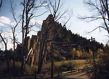
The approach
from the town of Stonewall (named for believe it or not a very impressive natural
stone wall--see photo above) begins on Road 13.0, which heads south from the
"Picketwire Lodge and Store" (appropriately named given the private
property paranoia thereabouts) At a T intersection after 5 or 6 miles I went
right on road 12.0, then a mile or so later right again on road 7.0. Soon the
road makes a sharp turn left at the gate for "Culebra Mountain Ranch"--
I made the turn and immediately started looking for a spot to hide my car.
 I "stashed" my car behind
some brush next to an abandoned house about a quarter mile south from the
Culebra Mountain Ranch entrance. I suppose my biggest worry with an old
car like mine is it getting towed off for junk! Since I'd noticed a red
building inside the ranch and thinking it might be a residence I cross-countried
to the south and around the building, passing through two fences--not easy
with Sam on the leash and carrying a full pack--before meeting up with the
dirt road west of the building. Suddenly I noticed a new house high on a
hill south of the road with picture windows facing towards me! Staying behind
cover I found a new road leading up to the house and followed until I was
sure that was where it went. No one had driven on it since the last rain.
Really I saw no evidence of anyone whether footprints or vehicle tracks
anywhere "back there". The next day on the way back I just walked directly
to the gate before passing under the fence. No one at home at the red building
(turned out to just be an empty stable) or at the house on the hill.
I "stashed" my car behind
some brush next to an abandoned house about a quarter mile south from the
Culebra Mountain Ranch entrance. I suppose my biggest worry with an old
car like mine is it getting towed off for junk! Since I'd noticed a red
building inside the ranch and thinking it might be a residence I cross-countried
to the south and around the building, passing through two fences--not easy
with Sam on the leash and carrying a full pack--before meeting up with the
dirt road west of the building. Suddenly I noticed a new house high on a
hill south of the road with picture windows facing towards me! Staying behind
cover I found a new road leading up to the house and followed until I was
sure that was where it went. No one had driven on it since the last rain.
Really I saw no evidence of anyone whether footprints or vehicle tracks
anywhere "back there". The next day on the way back I just walked directly
to the gate before passing under the fence. No one at home at the red building
(turned out to just be an empty stable) or at the house on the hill. |
|
Just up the road from
the red stables the road branches left, right, and a deteriorating concrete
bridge leads straight ahead. I went straight on the road going west. This
road was the least maintained, but it went in the direction I wanted to
go--west. After half an hour or so the road forked left and across the
Vallejos Creek or continued straight along the right side of the creek.
The time was 6:30 P.M. and with darkness coming around 7 this time of
year I set up camp by the creek.
In this beautiful
setting with the babbling brook, absolute solitude and evening shadows
lengthening I cooked up a "family pack" of pork chops on one
stove and couscous on the other. As for the pork chops I only ate two
while Sam ate the other six or seven! Retiring to the tent after stargazing
I read from a recent book entitled "War Crimes" by Aryeh Neier--another
book in my ongoing effort to understand the mess in former Yugoslavia.
This book examines the efforts and rationale behind establishing war crimes
tribunals for the Yugoslavian and Rwandan civil wars. It also goes into
recent history of WWII and the Nazi and Japanese atrocities, as well as
how the emerging democracies in South America dealt with the legacy of
their military dictatorships and crimes.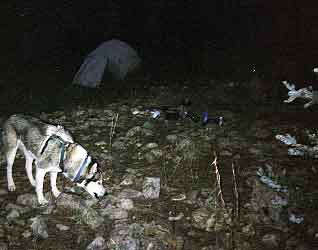
I also studied my
topo map for the next day's climb. Limited by the USGS topo for Culebra
Peak, which didn't extend as far east as I was, I had to employ guess
work to ensure I was on the correct jeep track. Before leaving my car
though I had a good look at the Colorado Atlas. West Northwest was the
direction I needed to go, so the next morning I followed the jeep track
along Vallejos Creek.
|
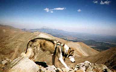
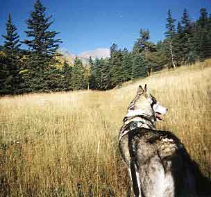
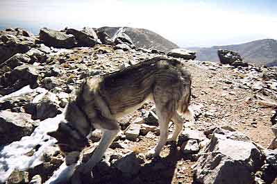
Thanks to Sam and
his "agenda" we got off to a late start, hitting the trail at
0740. I was ready to go by 0645, but Sam decided he was going to take
off after a scent. I put him on the leash when he finally showed up.
|
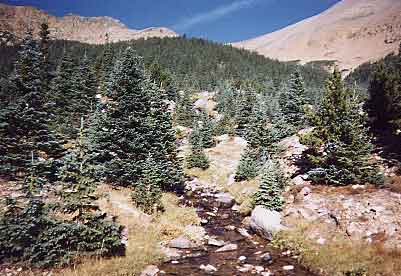
The jeep track continued
alongside the creek in a westerly direction. 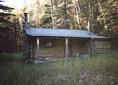 After crossing the creek a couple of times and an hour or so had gone by
we came on this hunter's cabin. I would think it would find some occupiers
later this month, once elk season is underway. It didn't look like anyone
had driven up the road all summer, though. The jeep track continued west,
on occasion disappearing in grassy fields.
After crossing the creek a couple of times and an hour or so had gone by
we came on this hunter's cabin. I would think it would find some occupiers
later this month, once elk season is underway. It didn't look like anyone
had driven up the road all summer, though. The jeep track continued west,
on occasion disappearing in grassy fields. |
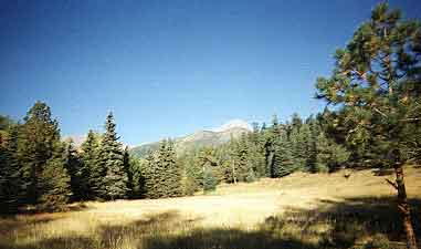 Now
and then the high peaks would pop up in the distance. The peak to the right
turned out to be Red Mountain. At the time I thought it was Culebra. As
I hiked west at least two roads branched off to the right. I kept to the
westerly track, following the creek. Now
and then the high peaks would pop up in the distance. The peak to the right
turned out to be Red Mountain. At the time I thought it was Culebra. As
I hiked west at least two roads branched off to the right. I kept to the
westerly track, following the creek. |
 After
1000 finally the trees became smaller as we neared the timberline. The creek
much smaller but no less scenic and delightful carried the melt-off from
recent snows above. I followed the track as it continued west, uncertain
whether the saddle above was to the left or to the right of Red Mountain. After
1000 finally the trees became smaller as we neared the timberline. The creek
much smaller but no less scenic and delightful carried the melt-off from
recent snows above. I followed the track as it continued west, uncertain
whether the saddle above was to the left or to the right of Red Mountain.
|
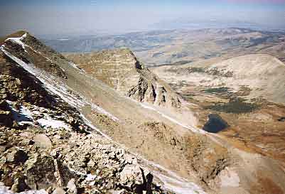
 As
we drew closer the cliffs directly west made it clear we were left of Red
Mountain. Looking right I could see a clear and easy course to the saddle
directly below Red Mountain. I continued on the jeep track, however, which
led us slightly left, but ever west and still higher. I reasoned that once
the jeep track ended I could then adjust to reach the saddle. No sense going
across the scree until absolutely necessary. Soon the track circled around
aiming back east again next to a dirty pond--obviously tramped up recently
by an elk herd. To the west a grassy steep knoll loomed. We scrambled up
hoping for a view from which to plan our route to the saddle. Once on the
knoll the choices were to continue west along the spine and towards the
cliffs, where it looked easy enough, but you never know, or to drop (lose
elevation, gasp!) to the right and ascend what looked like an easy scree
climb to the saddle. We dropped and went the easy route. Shortly we had
a better view of the route along the spine and it was easy enough. Still
we would then have had a longer ridge traverse to the right (north). Once
we reached the saddle the wind was cold and steady at about 30 MPH--the
less time on that ridge the better as it turned out. As
we drew closer the cliffs directly west made it clear we were left of Red
Mountain. Looking right I could see a clear and easy course to the saddle
directly below Red Mountain. I continued on the jeep track, however, which
led us slightly left, but ever west and still higher. I reasoned that once
the jeep track ended I could then adjust to reach the saddle. No sense going
across the scree until absolutely necessary. Soon the track circled around
aiming back east again next to a dirty pond--obviously tramped up recently
by an elk herd. To the west a grassy steep knoll loomed. We scrambled up
hoping for a view from which to plan our route to the saddle. Once on the
knoll the choices were to continue west along the spine and towards the
cliffs, where it looked easy enough, but you never know, or to drop (lose
elevation, gasp!) to the right and ascend what looked like an easy scree
climb to the saddle. We dropped and went the easy route. Shortly we had
a better view of the route along the spine and it was easy enough. Still
we would then have had a longer ridge traverse to the right (north). Once
we reached the saddle the wind was cold and steady at about 30 MPH--the
less time on that ridge the better as it turned out. |
|
 We
now had a formidable 1,000' of further elevation to gain to attain Red's
summit. The steady hard west 30MPH wind drove me east and below the ridge,
where it was almost calm not 20 feet from where the winds raged. We
now had a formidable 1,000' of further elevation to gain to attain Red's
summit. The steady hard west 30MPH wind drove me east and below the ridge,
where it was almost calm not 20 feet from where the winds raged.
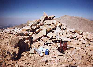
Atop Red, somehow
snow or rain had entered the register. I tried to dry it out, but it was
probably ruined.
|
 From
Red we dropped to maybe 13,000' or so before ascending again to Culebra's
14,047'. The going was easy enough, taking maybe an hour or so. Smog blowing
in from the west obscured the views somewhat. From
Red we dropped to maybe 13,000' or so before ascending again to Culebra's
14,047'. The going was easy enough, taking maybe an hour or so. Smog blowing
in from the west obscured the views somewhat. |
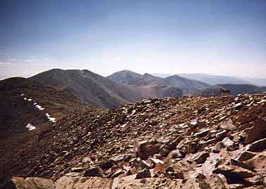
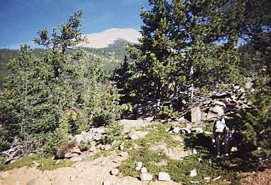
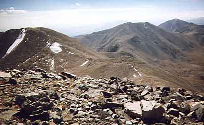
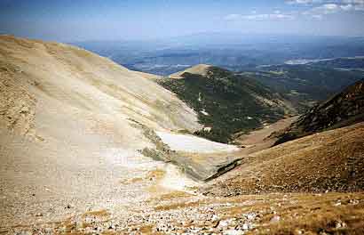
 The
photo left shows the view west from Culebra's summit. A nice alpine lake
is nestled at the foot of the slopes. The
photo left shows the view west from Culebra's summit. A nice alpine lake
is nestled at the foot of the slopes. |
 After
half an hour or so on Culebra, it was time to head down. Not wanting to
go back up and over Red, I elected to drop into the drainage between Red
and Culebra. The topo showed a jeep track reaching the saddle between Culebra
and Red, but I could find absolutely no trace of it. After
half an hour or so on Culebra, it was time to head down. Not wanting to
go back up and over Red, I elected to drop into the drainage between Red
and Culebra. The topo showed a jeep track reaching the saddle between Culebra
and Red, but I could find absolutely no trace of it. |
 Clearly
my course was directly down and into the drainage. Once below timberline
I could hook up with a jeep track shown on the topo heading south and connecting
with the Vallejos Creek road. It appeared easy enough, so we proceeded east,
losing elevation rapidly through scree and across grass. Clearly
my course was directly down and into the drainage. Once below timberline
I could hook up with a jeep track shown on the topo heading south and connecting
with the Vallejos Creek road. It appeared easy enough, so we proceeded east,
losing elevation rapidly through scree and across grass. |
|
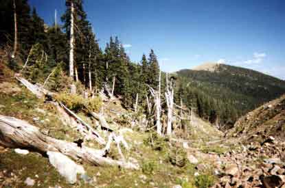 Once
at treeline an apparent chinook wind had blown down all trees low in the
drainage. I wouldn't have enjoyed being there in that moment. Once
at treeline an apparent chinook wind had blown down all trees low in the
drainage. I wouldn't have enjoyed being there in that moment.
Finally we connected
with the jeep track. Like the other jeep tracks, this one had long been
out of use. Some of the pine trees growing in the center of the road were
taller than me.
|
The jeep track traversed
alongside the east side of Red, just below timberline. After half an hour or
so we reached a high point where the road branched right and up the ridge west
towards Red, or dropped east. I knew we wanted to drop east towards Vallejos
Creek, still Sam pulled willfully in the direction west. Curious to see where
this road that was not on the topo ended up, I humored Sam for fifteen minutes
of steady hiking up hill towards Red's summit before turning around.
This would have been the
best course to have followed from the start. That is, follow the road ascending
right from the Vallejos Creek Trail (I marked it with a three stone cairn stack).
This road (which I now descended) ascends steeply alongside a dry gulch to an
easy ridgeline extending east from Red's summit.
Once on the main Vallejos
Creek jeep track I was on familiar ground, but still had a long ways to go.
Running much of the way, we finally reached our camp site 10 hours after having
left it early that morning. Everything was packed already, so we made haste
towards the car as evening darkness drew near.
Approaching my car on the
public dirt road (surrounded on both sides by barbed wire fence of course) I
noticed some farmers working the hay crop out in the field below my car. Thinking
that they would surely spot me walking and might get suspicious of someone hiking
with a backpack, I stealthily entered some scrub oak on the opposite side, fighting
my way through until I reached the clearing. Two horses from the field across
the road stood and stared at us as we desparately flailed through the thick
brush. I imagined the farmers wondering what the horses were looking at. Finally
I had to make my break across a 150 yard open space. Quickwalking, keeping low,
steady as you go, I moved toward my car. Out of the corner of my eye one of
the farmers was walking directly towards me, but he was still far away. A dog
barked from his truck not 100 feet away. Quickly pushing Sam in the back seat
and my pack shortly afterwards, I started the car, revved it (it much prefers
warming up slowly) and gunned it out of there. No one followed.
fourteeners