After getting off work around 4 P.M. that Friday afternoon, I quickly drove home, threw my gear in the trunk of my '59 Chevy, and was on I-25 southbound by 5:30. At Walsenberg, about 100 miles south of C.S. I turned west on US160, before heading south once again at the small town of Fort Garland. At the small towns from here on in I began stopping to ask at the hotels if they would allow dogs. None consented so I continued to drive into the night. Finally I pulled into a small no fee campground about 8 miles below Taos Ski Valley and slept in my front seat. I've done it before, but it's not the most comfortable as I can never stretch out completely. On the plus side I'm awake early and ready to move.
DRIVING ROUTE. (1) From the center of Taos take US 64 "west"(actual direction of travel being almost north) for about 5 miles.(2) At the flashing light, turn right on state route 150 (sign to Taos Ski Valley) and follow it 15 miles to the very end. (3) The trail begins at the uppermost ski parking lot, the trailhead being marked with a large signboard at 9400 ft.
My last attempt of this state highpoint was in December of '98, right after this range had been blasted with a blizzard of snow. On that occasion I had left my snowshoes in my car parked in the Taos Ski Valley parking lot. At 9,000 feet there wasn't a whole lot of snow. Once up to 11,000 feet the snow became so deep that there was no choice but to turn around. This year I would beat the snow.
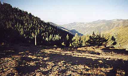
 The trail begins by climbing
steeply up alongside a creek for a mile or more before reaching a mining
road. The road ascends steeply to the Bull-of-the-Woods pasture at 10,800
ft. Here the old road goes almost directly south, skirting the west slope
of Bull-of-the-Woods Mountain and ending at a T-junction with a fine view
to the east at 11,500 ft. Here the mining road branches left and continues
to the mine site shown in the highpoint in the photo at right. You continue
south on a trail to some wooden railings (to keep out motor vehicle) and
the trail skirts Bull-of-theWoods Mountain, heading directly south.
The trail begins by climbing
steeply up alongside a creek for a mile or more before reaching a mining
road. The road ascends steeply to the Bull-of-the-Woods pasture at 10,800
ft. Here the old road goes almost directly south, skirting the west slope
of Bull-of-the-Woods Mountain and ending at a T-junction with a fine view
to the east at 11,500 ft. Here the mining road branches left and continues
to the mine site shown in the highpoint in the photo at right. You continue
south on a trail to some wooden railings (to keep out motor vehicle) and
the trail skirts Bull-of-theWoods Mountain, heading directly south.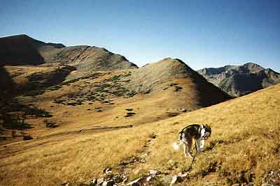 After
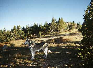
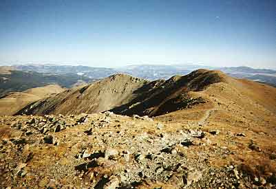
climbing gently through woods the trail moves out onto the tundra eventually
peaking at 12,160 ft on Frazer Mountain. There is still a ways to go to
reach Wheeler as the trail now drops into the woods before crossing two
small streams. There is a confusion of trails in this vicinity, just use
common sense and stay on the "well-beaten" path.
After
climbing gently through woods the trail moves out onto the tundra eventually
peaking at 12,160 ft on Frazer Mountain. There is still a ways to go to
reach Wheeler as the trail now drops into the woods before crossing two
small streams. There is a confusion of trails in this vicinity, just use
common sense and stay on the "well-beaten" path.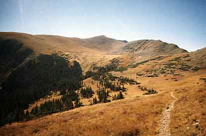 The
next goal is Walker Peak, named for someone from the area who "knew
and loved these mountains".
The
next goal is Walker Peak, named for someone from the area who "knew
and loved these mountains".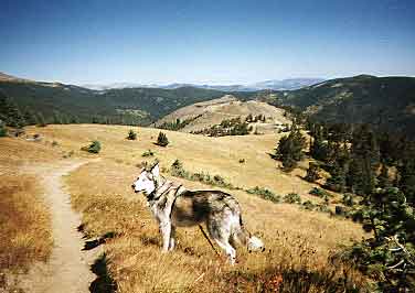 This
is high country. Once up along the long tundra trail the views are sweeping.
This
is high country. Once up along the long tundra trail the views are sweeping.
 The
summit was cold this morning, and a 25MPH wind only added to the chill.
I ducked behind the summit cairn for a bit, but didn't linger long before
heading back down.
The
summit was cold this morning, and a 25MPH wind only added to the chill.
I ducked behind the summit cairn for a bit, but didn't linger long before
heading back down. 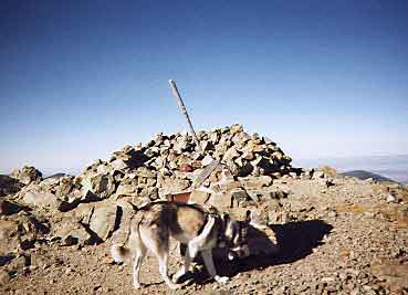 On
the way up I passed one other couple, but I was the first on the summit
that morning. Hiking back I counted more than 40 others on their way to
New Mexico's high point on this October day.
On
the way up I passed one other couple, but I was the first on the summit
that morning. Hiking back I counted more than 40 others on their way to
New Mexico's high point on this October day.